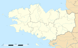
Gaël (Ille-et-Vilaine)
|
Gaël Gwazel |
||
|---|---|---|

Town hall
|
||
|
||
| Coordinates: 48°07′59″N 2°13′12″W / 48.1331°N 2.22°WCoordinates: 48°07′59″N 2°13′12″W / 48.1331°N 2.22°W | ||
| Country | France | |
| Region | Brittany | |
| Department | Ille-et-Vilaine | |
| Arrondissement | Rennes | |
| Canton | Saint-Méen-le-Grand | |
| Intercommunality | Pays de Saint-Méen-le-Grand | |
| Government | ||
| • Mayor (2014–2020) | Denis Levrel | |
| Area1 | 52.1 km2 (20.1 sq mi) | |
| Population (2008)2 | 1,580 | |
| • Density | 30/km2 (79/sq mi) | |
| Time zone | CET (UTC+1) | |
| • Summer (DST) | CEST (UTC+2) | |
| INSEE/Postal code | 35117 / 35290 | |
| Elevation | 51–131 m (167–430 ft) (avg. 80 m or 260 ft) |
|
|
1 French Land Register data, which excludes lakes, ponds, glaciers > 1 km² (0.386 sq mi or 247 acres) and river estuaries. 2Population without double counting: residents of multiple communes (e.g., students and military personnel) only counted once. |
||
1 French Land Register data, which excludes lakes, ponds, glaciers > 1 km² (0.386 sq mi or 247 acres) and river estuaries.
Gaël (Gallo: Gaèu) is a commune in the Ille-et-Vilaine department in Brittany in northwestern France.
It lies southwest of Rennes between Saint-Méen-le-Grand and Mauron. In the 18th century, a fair was held twice a year in August and October.
Old versions of the place-name include Guadel in 799, Wadel in 816, Vadel in 851, Wael in 1096, Gael as soon as 1112.
Its Breton name is Gwazel, that comes directly from Wadel > Gwadel > Gwazel, in Breton intervocalic [d] becomes [z], like in mezo ″drunk″, Welsh meddw ″drunk″. In French intervocalic [d] disappears totally : Wadel > Wael (Latin cadena > French chaine > English chain) and initial Germanic w- became gu- [gʷ] (+ -a) before becoming simply [g] : Guadel > Gael (cf. Old French guarder > French garder, English guard). The symbol ë means in Modern French that the preceding a has to be pronounced : Ga-el [gaɛl] (not [gɛʲl])
Nevertherless the place-name is not from Breton but from Gallo-Romance Wadellu(m), derived of Old Low Franconian *wad ″ford″ > French gué ″ford″ (Old Norman wei > Norman vey, Picard, Walloon wez). There were always Gallo-Romance speaking communities east of Saint-Brieuc and the Breton languages disappears totally around Gaël in the Middle Ages to be replaced by Gallo.
A main ford allowed to cross the Meu stream.
It is best known to English historians as being the ancestral seat of Ralph de Guader the first earl of Norfolk and Suffolk in post-Conquest England circa 1070 A.D.
This is an ancient Breton parish to the west of Rennes, whose boundaries formerly stretched to include the territories of Bran, Muel, Saint-Onen, Crouais, Saint-Méen-le-Grand, Concoret and Loscouët-sur-Meu. The parish of Gaël (Guadel) was a dependency of the Archbishopric of Saint-Malo. In the 6th and 7th centuries, Gaël was a major town in the kingdom of Domnonia.
...
Wikipedia


