Fritch, Texas
| Fritch, Texas | |
|---|---|
| City | |
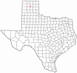
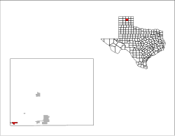
 Location of Fritch, Texas |
|
 |
|
| Coordinates: 35°38′23″N 101°36′3″W / 35.63972°N 101.60083°WCoordinates: 35°38′23″N 101°36′3″W / 35.63972°N 101.60083°W | |
| Country | United States |
| State | Texas |
| Counties | Hutchinson, Carson |
| Area | |
| • Total | 1.2 sq mi (3.1 km2) |
| • Land | 1.2 sq mi (3.1 km2) |
| • Water | 0.0 sq mi (0.0 km2) |
| Elevation | 3,196 ft (974 m) |
| Population (2010) | |
| • Total | 2,117 |
| • Density | 1,840.9/sq mi (710.8/km2) |
| Time zone | Central (CST) (UTC-6) |
| • Summer (DST) | CDT (UTC-5) |
| ZIP code | 79036 |
| Area code(s) | 806 |
| FIPS code | 48-27696 |
| GNIS feature ID | 1357770 |
Fritch is a city in Hutchinson and Moore counties in the U.S. state of Texas. The population was 2,117 at the 2010 census. Fritch and the surrounding area is served by ZIP code 79036. The town is colloquially known as "Fritch, America." The current Mayor is Kelly Hendersan.
On May 11, 2014 a fast moving wildfire in the area began causing much destruction and loss of homes in the Fritch area which was evacuated by authorities. Media reported 100 structures destroyed with numerous people in local shelters.
Fritch is located at 35°38′23″N 101°36′3″W / 35.63972°N 101.60083°W (35.639639, -101.600921) in the geographic center of the Texas Panhandle region. It is 30 miles north-northeast of Amarillo and 15 miles west of Borger in an area of where the typically flat High Plains are broken up into canyons and draws by the Canadian River. The city itself sits on a flat piece of land surrounded by undulating terrain due to this phenomenon.
According to the United States Census Bureau, the city has a total area of 1.2 square miles (3.1 km²), all of it land. Lake Meredith lies just outside the city of Fritch and is a main source of water for surrounding communities, though the city actually uses well water drawn from the Ogallala Aquifer for its municipal water supply.
...
Wikipedia
