Freeport, Maine
| Freeport, Maine | ||
|---|---|---|
| Town | ||

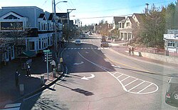
View of downtown
|
||
|
||
| Nickname(s): The Birthplace of Maine | ||
 Location in Cumberland County and the state of Maine. |
||
| Coordinates: 43°50′38″N 70°6′6″W / 43.84389°N 70.10167°WCoordinates: 43°50′38″N 70°6′6″W / 43.84389°N 70.10167°W | ||
| Country | United States | |
| State | Maine | |
| County | Cumberland | |
| Incorporated | February 14, 1789 | |
| Area | ||
| • Total | 46.47 sq mi (120.36 km2) | |
| • Land | 34.70 sq mi (89.87 km2) | |
| • Water | 11.77 sq mi (30.48 km2) | |
| Elevation | 36 ft (11 m) | |
| Population (2010) | ||
| • Total | 7,879 | |
| • Estimate (2012) | 8,039 | |
| • Density | 227.1/sq mi (87.7/km2) | |
| Time zone | Eastern (EST) (UTC-5) | |
| • Summer (DST) | EDT (UTC-4) | |
| ZIP codes | 04032-04034 | |
| Area code(s) | 207 | |
| FIPS code | 23-26525 | |
| GNIS feature ID | 0582481 | |
| Website | www |
|
Freeport is a town in Cumberland County, Maine, United States. The population was 7,879 at the 2010 census. Known for its numerous outlet stores, Freeport is home to L.L. Bean, Wolfe's Neck Woods State Park, and the Desert of Maine.
Freeport is part of the Portland–South Portland–Biddeford, Maine metropolitan statistical area.
The town was once a part of North Yarmouth called Harraseeket, after the Harraseeket River. First settled about 1700, it was set off and incorporated on February 14, 1789 as Freeport. It is probably named "from the openness of its harbor" (free from ice). Freeport developed as four villages—Mast Landing, Porter's Landing, South Freeport and Freeport Corner—all of which are now part of the Harraseeket Historic District, listed on the National Register of Historic Places.
At the head of tide on the Harraseeket River is Mast Landing, from which timber was shipped, particularly for use as masts. The estuary was dammed to provide water power for a gristmill, sawmill and fulling mill, with modest manufacturing and woodworking. Porter's Landing was involved in shipbuilding, important in Freeport following the Revolutionary War. The industry reached its peak in the decade between 1850 and 1860, but declined with the Civil War. South Freeport, the largest of the waterfront villages, once had four shipyards. Other businesses included fishing, canning and farming. In 1903, the Casco Castle and Amusement Park was built here by Amos Gerald to encourage travel by trolley cars. The hotel burned in 1914, but its tower still stands. Freeport Corner was an inland village for farming and trade, but the 1849 entrance of the railroad helped it develop into the town's commercial center, which it remains. In the 1800s, fabric was sent from New York and Boston to be made into clothing by local piece workers. Businessman E. B. Mallet established here a sawmill, brickyard, granite quarry and large shoe factory.
...
Wikipedia

