Frankston, Texas
| Frankston, Texas | |
|---|---|
| Town | |
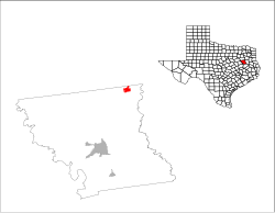
 Location of Frankston, Texas |
|
 |
|
| Coordinates: 32°3′14″N 95°30′24″W / 32.05389°N 95.50667°WCoordinates: 32°3′14″N 95°30′24″W / 32.05389°N 95.50667°W | |
| Country | United States |
| State | Texas |
| County | Anderson |
| Area | |
| • Total | 2.5 sq mi (6.4 km2) |
| • Land | 2.5 sq mi (6.4 km2) |
| • Water | 0.0 sq mi (0.0 km2) |
| Elevation | 420 ft (128 m) |
| Population (2010) | |
| • Total | 1,229 |
| • Density | 495/sq mi (191.3/km2) |
| Time zone | Central (CST) (UTC-6) |
| • Summer (DST) | CDT (UTC-5) |
| ZIP code | 75763 |
| Area code(s) | 430, 903 |
| FIPS code | 48-27300 |
| GNIS feature ID | 1373769 |
| Website | www |
Frankston is a town in Anderson County, Texas, United States. The population was 1,229 at the 2010 census. Frankston was named for Frankie Miller, a young woman who donated land for the downtown city park.
Frankston is located in northeastern Anderson County at 32°3′14″N 95°30′24″W / 32.05389°N 95.50667°W (32.053827, -95.506528), at the intersection of U.S. Highway 175 and State Highway 155.
According to the United States Census Bureau, the town has a total area of 2.5 square miles (6.4 km2), all of it land.
An alternate theory for the name of the town was that Frankston was named after Frank Miller who owned the land when the railway was built. The Miller house still stands as a historical landmark in the southeast part of town, down ACR 19. The state bought the land from him and named the city in his honor. The original Main Street still holds the name Miller Street. The junction of highways 155 and 175 is now the central point of the town.
A railroad line operated by the Southern Pacific Railroad (originally built and operated by the Texas & New Orleans Railroad) served Frankston from 1902 until its abandonment in the mid-1980s. The only remaining vestige of the rail line in the city is a building used by the railroad company as a depot; it now serves as Frankston's public library.
As of the census of 2000, there were 1,209 people, 472 households, and 320 families residing in the town. The population density was 488.6 people per square mile (189.0/km²). There were 525 housing units at an average density of 212.2 per square mile (82.1/km²). The racial makeup of the town was 86.68% White, 10.92% African American, 0.17% Native American, 0.08% Asian, 0.91% from other races, and 1.24% from two or more races. Hispanic or Latino of any race were 2.81% of the population.
...
Wikipedia
