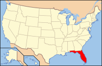
Franklin County, Florida
| Franklin County, Florida | |
|---|---|

Franklin County Courthouse
|
|
 Location in the U.S. state of Florida |
|
 Florida's location in the U.S. |
|
| Founded | February 8, 1832 |
| Named for | Benjamin Franklin |
| Seat | Apalachicola |
| Largest community | Eastpoint |
| Area | |
| • Total | 1,026 sq mi (2,657 km2) |
| • Land | 535 sq mi (1,386 km2) |
| • Water | 492 sq mi (1,274 km2), 47.9% |
| Population (est.) | |
| • (2015) | 11,761 |
| • Density | 22/sq mi (8/km²) |
| Congressional district | 2nd |
| Time zone | Eastern: UTC-5/-4 |
| Website | www |
Franklin County is a county along the Gulf of Mexico in the Florida panhandle of the U.S. state of Florida. As of the 2010 census, the population was 11,549, making it the third-least populous county in Florida. The county seat is Apalachicola.
The county includes several large preserved areas and rivers and has been home to commercial timber and fishing industry. More recently it has become popular for tourism and retirement. It includes several rivers, state parks, and islands.
The entire coast line of Franklin County was inhabited by Native Americans for about 12,000 years. Life along the coast was good since seafood was abundant. They traded with the Native Americans in Tallahassee for clay and other items not available on the coast. One style of pottery first found in Carrabelle is named Carrabelle Punctuated. A clay pot was made and, while still damp, the potter would take a small stick of a similar object and press the end of the stick into the clay numerous times until the entire pot was covered with small indentations. It was then placed into a shallow pit, covered with small tree branches, and fired. The result was a decorated water resistant pot.
Franklin County was founded in 1832. It was named for Benjamin Franklin.
The second largest town in Franklin County is Carrabelle, 25 miles east of Apalachiola on the Carrabelle River.
During World War II most of Franklin County was used by the U.S. military for jungle training. The beaches and islands were ideal for amphibious training. When the war ended and the military left, Lanark Village was established from the remaining Officer's quarters.
According to the U.S. Census Bureau, the county has a total area of 1,026 square miles (2,660 km2), of which 535 square miles (1,390 km2) is land and 492 square miles (1,270 km2) (47.9%) is water.
...
Wikipedia
