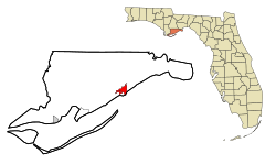
Carrabelle
| Carrabelle, Florida | |
|---|---|
| City | |
 Location in Franklin County and the state of Florida |
|
| Location in the United States | |
| Coordinates: 29°51′14″N 84°39′57″W / 29.85389°N 84.66583°WCoordinates: 29°51′14″N 84°39′57″W / 29.85389°N 84.66583°W | |
| Country |
|
| State |
|
| County | Franklin |
| Rio Carrabella | 1877 |
| Carrabelle (Incorporated) | May 11, 1893 |
| Government | |
| • Type | Commission |
| • Mayor | Brenda La Paz |
| Area | |
| • Total | 5.6 sq mi (14.6 km2) |
| • Land | 4.5 sq mi (11.7 km2) |
| • Water | 1.1 sq mi (2.9 km2) |
| Elevation | 26 ft (8 m) |
| Population (2010) | |
| • Total | 2,778 |
| • Density | 617/sq mi (238.3/km2) |
| Time zone | Eastern (EST) (UTC-5) |
| • Summer (DST) | EDT (UTC-4) |
| ZIP code | 32322 |
| Area code(s) | 850 |
| FIPS code | 12-10725 |
| GNIS feature ID | 0280069 |
| Website | www |
Carrabelle is a city in Franklin County along Florida's Panhandle, United States. The population was 2,778 as of the 2010 census. Carrabelle is located east of Apalachicola at the mouth of the Carrabelle River on the Gulf of Mexico.
Carrabelle is located east of the center of Franklin County along the Carrabelle River, between St. George Sound to the south and the Crooked and New rivers to the north. To the south is Dog Island, separating St. George Sound from the Gulf of Mexico.
U.S. Route 98 passes through Carrabelle, leading west 22 miles (35 km) to Apalachicola and northeast 30 miles (48 km) to Medart. Tallahassee, the state capital, is 54 miles (87 km) to the northeast.
According to the United States Census Bureau, Carrabelle has a total area of 5.6 square miles (14.6 km2), of which 4.5 square miles (11.7 km2) is land and 1.1 square miles (2.9 km2), or 20.12%, is water.
Carrabelle is the eastern terminus of the Gulf Intracoastal Waterway.
The population of Carrabelle rose from 1,303 in 2000 to 2,778 in 2010 with the expansion of the city limits to the northeast to include the Franklin Correctional Institution.
As of the census of 2010, there were 2,778 people, 1,243 households, and 560 families residing in the city. The population density was 349.2 inhabitants per square mile (134.9/km²). There were 790 housing units at an average density of 211.7 per square mile (81.8/km²). The racial makeup of the city was 91.48% White, 5.68% African American, 0.31% Native American, 0.08% Asian, 0.08% Pacific Islander, 0.84% from other races, and 1.53% from two or more races. Hispanic or Latino of any race were 1.61% of the population.
...
Wikipedia

