Franklin, Indiana
| Franklin, Indiana | ||
|---|---|---|
| City | ||
| City of Franklin | ||

Johnson County courthouse in Franklin
|
||
|
||
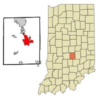
 Location in the state of Indiana |
||
| Coordinates: 39°29′23″N 86°03′24″W / 39.48972°N 86.05667°WCoordinates: 39°29′23″N 86°03′24″W / 39.48972°N 86.05667°W | ||
| Country | United States | |
| State | Indiana | |
| County | Johnson | |
| Township | Franklin | |
| Government | ||
| • Mayor | Steve Barnett (I) | |
| Area | ||
| • Total | 13.01 sq mi (33.70 km2) | |
| • Land | 13.01 sq mi (33.70 km2) | |
| • Water | 0 sq mi (0 km2) | |
| Elevation | 725 ft (221 m) | |
| Population (2010) | ||
| • Total | 23,712 | |
| • Estimate (2012) | 23,953 | |
| • Density | 1,822.6/sq mi (703.7/km2) | |
| Time zone | EST (UTC-5) | |
| • Summer (DST) | EDT (UTC-4) | |
| ZIP code | 46131 | |
| Area code(s) | 317 | |
| FIPS code | 18-25450 | |
| GNIS feature ID | 0434762 | |
| Website | http://www.franklin.in.gov/ | |
Franklin is a city in Johnson County, Indiana, United States. The population was 23,712 at the 2010 census. Located about 20 miles south of Indianapolis, the city is the county seat of Johnson County. The site of Franklin College, the city attracts numerous regional sports fans for the college teams, as well as audiences for its art events.
Franklin was platted in 1823. It was named after Benjamin Franklin. The Franklin post office was established in 1824.
Bethel African Methodist Episcopal Church, Franklin College Library (Shirk Hall), Franklin College-Old Main, Franklin Commercial Historic District, Franklin Senior High School, Greenlawn Cemetery, Herriott House, Johnson County Courthouse Square, Martin Place Historic District, Masonic Temple, and August Zeppenfeld House are listed on the National Register of Historic Places.
...
Wikipedia

