Fossil Creek
| Fossil Creek (Hakhavsuwa) | |
|
Above the dam in 2004
|
|
| Name origin: the resemblance to fossils of the stream's rocks and vegetation, coated with travertine | |
| Country | United States |
|---|---|
| State | Arizona |
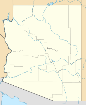
| County | Coconino, Yavapai, Gila |
| City | Strawberry |
| Source | |
| - elevation | 6,510 ft (1,984 m) |
| - coordinates | 34°26′07″N 111°30′31″W / 34.43528°N 111.50861°W |
| Mouth | Verde River |
| - elevation | 2,543 ft (775 m) |
| - coordinates | 34°18′21″N 111°40′32″W / 34.30583°N 111.67556°WCoordinates: 34°18′21″N 111°40′32″W / 34.30583°N 111.67556°W |
| Length | 17 mi (27 km) |
| Basin | 135 sq mi (350 km2) |
| Discharge | for Fossil Creek Bridge |
| - average | 43 cu ft/s (1 m3/s) |
| - max | 885 cu ft/s (25 m3/s) |
| - min | 39 cu ft/s (1 m3/s) |
|
Fossil Creek proposal map (March 2011)
|
|
Fossil Creek (Yavapai: Hakhavsuwa or Vialnyucha) is a perennial stream near the community of Strawberry in the U.S. state of Arizona. A tributary of the Verde River, Fossil Creek flows from its headwaters on the Mogollon Rim to meet the larger stream near the former Childs Power Plant.
Fossil Springs, near the headwaters, emits upwards of 20,000 US gallons (76 m3) per minute that flow into the creek year-round. Calcium carbonate, precipitating from the 72 °F (22 °C) water from the springs, creates travertine dams and deposits for several miles downstream. The Fossil Creek system is the fourth largest producer of travertine in the United States.
Fossil Creek is one of only two streams in Arizona included in the National Wild and Scenic Rivers System. The creek and its riparian corridor provide habitat for a wide variety of flora and fauna, some listed as endangered or otherwise imperiled. Its former power-plant complex is listed as a National Historic District. Since restoration of the stream's natural flow in 2008, an increase in recreational visits has raised concerns about overuse and has led to road closings and other restrictions.
Fossil Creek arises at an elevation of 6,510 feet (1,980 m) above sea level on the Mogollon Rim in Coconino County north of Strawberry. For about the first 3 miles (5 km), the creek's flow is intermittent.
From high on the rim, the creek runs generally north, entering Gila County almost immediately. It continues north through the wilderness to the confluence of an intermittent stream in Calf Pen Canyon, which enters from the . Turning west, the creek receives another intermittent stream from the right in Sandrock Canyon, at the head of Fossil Creek Canyon. Before it reaches Fossil Springs, the creek becomes the boundary between Gila County on the stream's and Yavapai County on its right, and it remains the boundary all the way to the Verde River.
...
Wikipedia


