Fort Good Hope
|
Fort Good Hope Rádeyîlîkóé |
|
|---|---|
| Charter Community | |
 |
|
| Coordinates: 66°15′31″N 128°37′43″W / 66.25861°N 128.62861°WCoordinates: 66°15′31″N 128°37′43″W / 66.25861°N 128.62861°W | |
| Country | Canada |
| Territory | Northwest Territories |
| Region | Sahtu Region |
| Constituency | Sahtu |
| Census division | Region 2 |
| Charter Community | 1 April 1995 |
| Government | |
| • Chief | Wilfred Mcneely Jr. |
| • Senior Administrative Officer | Gordon MacKeinzo |
| • MLA | Norman Yakeleya |
| Area | |
| • Land | 47.14 km2 (18.20 sq mi) |
| Elevation | 268 m (879 ft) |
| Population (2011) | |
| • Total | 515 |
| • Density | 10.9/km2 (28/sq mi) |
| Time zone | Mountain (MST) (UTC-7) |
| • Summer (DST) | MDT (UTC-6) |
| Canadian Postal code | X0E 0H0 |
| Area code(s) | 867 |
| Telephone exchange | 598 |
| - Living cost | 172.5 |
| - Food price index | 180.2 |
| Sources: Department of Municipal and Community Affairs, Prince of Wales Northern Heritage Centre, Canada Flight Supplement ^A 2009 figure based on Edmonton = 100 ^B 2010 figure based on Yellowknife = 100 |
|
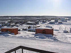
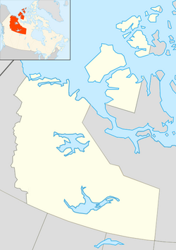
Fort Good Hope (or the Charter Community of K'asho Got'ine) is a charter community in the Sahtu Region of the Northwest Territories, Canada. It is located on a peninsula between Jackfish Creek and the east bank of the Mackenzie River, about 145 km (90 mi) northwest of Norman Wells. The two principal languages are North Slavey and English. Hunting and trapping are two major sources of income.
According to the 2011 Census the population was 515, a decrease of 7.5% from the 2006 Census. In 2006 the Aboriginal population was 515, of which 460 were North American Indians, 40 Métis people and 10 Inuit. In 2012 the Government of the Northwest Territories reported that the population was 559 with an average yearly growth rate of -0.5% from 2001.
The only all season access is by air, Fort Good Hope Airport, with flights operated by North-Wright Airways from Inuvik, Norman Wells and Colville Lake. The community can be accessed in summer using the Mackenzie River. There is no passenger service and the route is primarily used by the Northern Transportation Company for the summer sealift. Winter access is possible via a winter road from Wrigley located further south. The NWT government is seeking federal funding to help extend the Mackenzie Highway from Wrigley to Tsiigehtchic, where it would connect with the Dempster Highway, as of winter 2014 at least eight major river crossings are in place for the new road, some of which are in use as winter crossings.
...
Wikipedia

