Forks of the Credit Provincial Park
| Forks of the Credit Provincial Park | |
|---|---|
|
IUCN category II (national park)
|
|

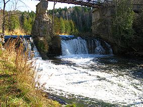
Credit River flowing through Forks of the Credit Provincial Park
|
|
| Location | Ontario, Canada |
| Nearest city | Caledon, Ontario |
| Coordinates | 43°48′58″N 80°00′43″W / 43.816°N 80.012°WCoordinates: 43°48′58″N 80°00′43″W / 43.816°N 80.012°W |
| Area | 282 hectares (700 acres) |
| Established | 1985 |
| Governing body | Ontario Parks |
Forks of the Credit Provincial Park, located in Caledon, Ontario, Canada is part of the Ontario Parks system and is part of the Niagara Escarpment biosphere. The park is on the Bruce Trail. The Credit River runs through the park. Other notable features of the park include a kettle lake, and talus slope.
In 1968 the Niagara Escarpment Study recommended that a park be established in the Forks of the Credit area, this recommendation was then accepted by the Government of Ontario. It was officially regulated as a provincial park in 1985.
There has been a mill in the area since 1820. In 1885, John Deagle bought the mill at the top of the falls and converted it into an electrical generating station, damming the river and creating Cataract Lake. Later the station was purchased by Ontario Hydro, and was eventually shut down in 1947. The dam was destroyed in 1953, and the lake drained. The ruins of the mill and powerhouse are located within the park.
...
Wikipedia

