Fluvanna County
| Fluvanna County, Virginia | ||
|---|---|---|

Fluvanna County Courthouse, January 2014
|
||
|
||
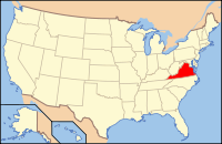
 Location in the U.S. state of Virginia |
||
 Virginia's location in the U.S. |
||
| Founded | 1777 | |
| Named for | Fluvanna River | |
| Seat | Palmyra | |
| Largest town | Columbia | |
| Area | ||
| • Total | 290 sq mi (751 km2) | |
| • Land | 286 sq mi (741 km2) | |
| • Water | 4.1 sq mi (11 km2), 1.4% | |
| Population (est.) | ||
| • (2016) | 26,133 | |
| • Density | 91/sq mi (35/km²) | |
| Congressional district | 5th | |
| Time zone | Eastern: UTC-5/-4 | |
| Website | fluvannacounty |
|
Fluvanna County is a county located in the Piedmont region of the Commonwealth of Virginia. As of the 2010 census, the population was 25,691. Its county seat is Palmyra.
Fluvanna County is part of the Charlottesville, Virginia Metropolitan Statistical Area.
Through the 17th century, the Point of Fork (near Columbia where the James and Rivanna rivers meet) was the site of Rassawek, a major Monacan village of the Native Americans. By 1701, the Seneca Iroquois had overrun the entire Virginia Piedmont, which they sold to Virginia Colony in 1721 at the Treaty of Albany.
The area which is now Fluvanna County was once considered part of Henrico County, one of the original shires of the Virginia Colony. Henrico was divided in 1727 and the Fluvanna County area became a part of Goochland County. In 1744 Goochland was divided and the area presently known as Fluvanna became a part of Albemarle County. When Amherst County, Nelson County and Buckingham County were split off from Albemarle County, the Albemarle County Seat was moved in 1762 from Scottsville to Charlottesville. When the Albemarle County Seat was moved citizens in the Fluvanna area would now have to trek over the Southwest Mountains to reach the new Albemarle County Seat at Charlottesville. Fluvanna area citizens lobbied the Virginia General Assembly to create a new county. Finally, in 1777, Albemarle County was divided again and Fluvanna County established.
...
Wikipedia

