Firebaugh, California
| Firebaugh, California | |||||
|---|---|---|---|---|---|
| City | |||||
| City of Firebaugh | |||||

Northbound N St. (Highway 33) at 13th Street in 2006.
|
|||||
|
|||||
| Motto: "The Jewel of the San Joaquin!" | |||||
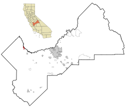
 Location in Fresno County and the U.S. state of California |
|||||
| Location in the United States | |||||
| Coordinates: 36°51′32″N 120°27′22″W / 36.85889°N 120.45611°WCoordinates: 36°51′32″N 120°27′22″W / 36.85889°N 120.45611°W | |||||
| Country | United States of America | ||||
| State | California | ||||
| County | Fresno | ||||
| Incorporated | September 17, 1914 | ||||
| Government | |||||
| • Mayor | Craig Knight | ||||
| • Mayor Pro Tem | Chris DeFrancesco | ||||
| • State senator | Jean Fuller (R) | ||||
| • State assemblyman | Joaquin Arambula (D) | ||||
| • Congressman | David Valadao (R) | ||||
| Area | |||||
| • Total | 3.519 sq mi (9.114 km2) | ||||
| • Land | 3.462 sq mi (8.967 km2) | ||||
| • Water | 0.057 sq mi (0.148 km2) 1.62% | ||||
| Elevation | 151 ft (46 m) | ||||
| Population (2010) | |||||
| • Total | 7,549 | ||||
| • Density | 2,100/sq mi (830/km2) | ||||
| Time zone | PST (UTC-8) | ||||
| • Summer (DST) | PDT (UTC-7) | ||||
| ZIP code | 93622 | ||||
| Area code(s) | 559 | ||||
| FIPS code | 06-24134 | ||||
| GNIS feature IDs | 277514, 2410507 | ||||
| Website | www |
||||
Firebaugh (formerly, Firebaugh's Ferry) is a city in Fresno County, California, United States. The population was 7,549 at the 2010 census, up from 5,743 as of the 2000 census. The ZIP Code for the community is 93622 and the city is located inside area code 559. Firebaugh is located on the west side of the San Joaquin River 38 miles (61 km) west of Fresno, at an elevation of 151 feet (46 m). Inside the city, a small commercial district includes the ubiquitous California Central Valley water tank painted with the city's name. State Route 33 (SR 33) runs through downtown just west of center. The San Joaquin Valley Railroad, West Side Subdivision, passes through downtown.
Outside of city, the area is almost entirely agricultural land in all directions. Most fields of irrigated row crops along SR33 are feed crops such as alfalfa.
The city is named for Andrew D. Firebaugh (also spelled Fierbaugh), an area entrepreneur. During the Gold Rush, Firebaugh's most famous local enterprise was a ferry boat. It shuttled people across the San Joaquin River. He also built a toll road from Bell Station to Pacheco Pass. The toll road went along a route parallel to present-day State Route 152.
Firebaugh was a station on the Butterfield Overland Stage.
The Firebaugh's Ferry post office operated from 1860 to 1862. The Firebaugh post office opened in 1865.
In the 1880s, the area of Firebaugh was once part of the massive holdings of the Miller and Lux Company. The company had a large sheep operation covering what today is Dos Palos to Mendota.
...
Wikipedia


