California State Route 152
| State Route 152 | ||||
|---|---|---|---|---|

Map of western California with SR 152 highlighted in red
|
||||
| Route information | ||||
| Defined by | ||||
| Maintained by Caltrans | ||||
| Length: | 104.419 mi (168.046 km) (plus about 1.5 mi (2.5 km) on US 101) |
|||
| History: | State highway in 1916; SR 152 in 1934 | |||
| Restrictions: | No tractor-trailer combinations over 45 feet (14 m) in length through Hecker Pass | |||
| Major junctions | ||||
| West end: |
|
|||
| East end: |
|
|||
| Highway system | ||||
|
||||
|
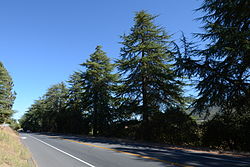
Highway 152 Tree Row
|
|
 |
|
| Nearest city | Gilroy, California |
|---|---|
| Built | 1930-1931 |
| NRHP Reference # | 07000635 |
| Added to NRHP | July 3, 2007 |
State Route 152 (SR 152) is a state highway that runs near the latitudinal middle of the U.S. state of California from Watsonville to Route 99 southeast of Merced. Its western portion (which is also known as Pacheco Pass Road and Pacheco Pass Highway) provides access to and from Interstate 5 toward southern California for motorists in or near Gilroy and San Jose.
This route is part of the California Freeway and Expressway System and is eligible for the State Scenic Highway System.
Route 152 begins near Route 1 as a series of local streets that run through downtown Watsonville: East Lake Avenue carries it to the intersection of Casserly Road. This point marks the start of a winding two-lane highway that crosses the Santa Cruz Mountains through Hecker Pass to reach Gilroy. In Gilroy, it is again carried on a series of local streets, then overlapped onto U.S. Route 101 for a small stretch before it separates again a short distance to the south and returns to heading east/west on more local streets in Gilroy.
...
Wikipedia

