Falcon Heights, Texas
| Falcon Heights, Texas | |
|---|---|
| CDP | |
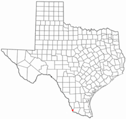
 Location of Falcon Heights, Texas |
|
 |
|
| Coordinates: 26°33′37″N 99°7′21″W / 26.56028°N 99.12250°WCoordinates: 26°33′37″N 99°7′21″W / 26.56028°N 99.12250°W | |
| Country | United States |
| State | Texas |
| County | Starr |
| Area | |
| • Total | 0.1 sq mi (0.3 km2) |
| • Land | 0.1 sq mi (0.3 km2) |
| • Water | 0.0 sq mi (0 km2) |
| Elevation | 272 ft (83 m) |
| Population (2010) | |
| • Total | 53 |
| • Density | 530/sq mi (200/km2) |
| Time zone | Central (CST) (UTC-6) |
| • Summer (DST) | CDT (UTC-5) |
| ZIP code | 78545, 78584 |
| Area code(s) | 956 |
| FIPS code | 48-25344 |
| GNIS feature ID | 1335664 |
Falcon Heights is a census-designated place (CDP) in Starr County, Texas, United States. The population was 53 at the 2010 census down from 335 at the 2000 census.
The Lake Falcon Dam International Crossing connects Falcon Heights with Nueva Ciudad Guerrero, Tamaulipas.
Falcon Heights is located at 26°33′37″N 99°7′21″W / 26.56028°N 99.12250°W (26.560372, -99.122493).
Prior to the 2010 census, Falcon Heights CDP had parts taken to form new CDPs and lost additional area. As a result, the total area was reduced to 0.1 square miles (0.3 km²), all land.
As of the census of 2000, there were 335 people, 99 households, and 81 families residing in the CDP. The population density was 76.4 people per square mile (29.5/km²). There were 152 housing units at an average density of 34.7 per square mile (13.4/km²). The racial makeup of the CDP was 99.70% White, 0.30% from other races. Hispanic or Latino of any race were 94.93% of the population.
...
Wikipedia
