Fairmount, Illinois
| Fairmount | |
|---|---|
| Village | |
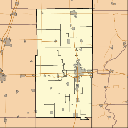
 Location of Fairmount in Vermilion County, Illinois. |
|
| Fairmount's location in Vermilion County | |
| Coordinates: 40°2′42″N 87°49′48″W / 40.04500°N 87.83000°WCoordinates: 40°2′42″N 87°49′48″W / 40.04500°N 87.83000°W | |
| Country | United States |
| State | Illinois |
| County | Vermilion |
| Township | Vance |
| Incorporated | 1863 |
| Area | |
| • Total | 0.32 sq mi (0.82 km2) |
| • Land | 0.32 sq mi (0.82 km2) |
| • Water | 0.00 sq mi (0.00 km2) 0% |
| Elevation | 666 ft (203 m) |
| Population (2010) | |
| • Total | 642 |
| • Estimate (2016) | 609 |
| • Density | 1,927.22/sq mi (744.33/km2) |
| Time zone | CST (UTC-6) |
| • Summer (DST) | CDT (UTC-5) |
| ZIP code | 61841 |
| Area code(s) | 217 |
| FIPS code | 17-24985 |
Fairmount is a village in Vance Township, Vermilion County, Illinois, United States. It is part of the Danville, Illinois Metropolitan Statistical Area. The population was 640 at the 2000 census.
Josiah Hunt, a railroad engineer, reportedly used inside information about the coming of the Great Western Railroad to purchase 40 acres (160,000 m2) of land along the new route to found a town. He originally named the town Salina, but this was changed because of an existing Illinois town named Saline; Francis Dougherty, an early settler, is said to have selected the name Fairmount. The town was incorporated in 1863.
Coal mining was attempted east of Fairmount, but this proved to be impractical because of water. Later, Jacob C. Sandusky discovered an outcropping of limestone in his farm, and quarries were established which at one time employed about 400 people. The quarries are now flooded and make a popular fishing location.
Fairmount is located at 40°2′42″N 87°49′48″W / 40.04500°N 87.83000°W (40.045124, -87.829879).
According to the 2010 census, Fairmount has a total area of 0.32 square miles (0.83 km2), all land.
As of the census of 2000, there were 640 people, 264 households, and 190 families residing in the village. The population density was 2,055.4 people per square mile (797.1/km²). There were 280 housing units at an average density of 899.2 per square mile (348.7/km²). The racial makeup of the village was 98.75% White, 0.31% African American, 0.16% Asian, 0.16% from other races, and 0.62% from two or more races. Hispanic or Latino of any race were 0.62% of the population.
...
Wikipedia

