Fairmont City, Illinois
| Fairmont City | |
| Village | |
| Country | United States |
|---|---|
| State | Illinois |
| County | St. Clair and Madison |
| Coordinates | 38°39′4″N 90°5′59″W / 38.65111°N 90.09972°WCoordinates: 38°39′4″N 90°5′59″W / 38.65111°N 90.09972°W |
| Area | 6.59 sq mi (17 km2) |
| - land | 6.20 sq mi (16 km2) |
| - water | 0.39 sq mi (1 km2) |
| Population | 2,635 (2010) |
| Density | 164.1/km2 (425/sq mi) |
| Timezone | CST (UTC-6) |
| - summer (DST) | CDT (UTC-5) |
| Postal code | 62201 |
| Area code | 618 |
|
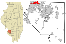
Location in St. Clair County and the state of Illinois.
|
|
|
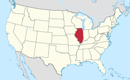
Location of Illinois in the United States
|
|
|
Website: www |
|
Fairmont City is a village in St. Clair and Madison counties, Illinois, United States. The population was 2,635 at the 2010 census. In the 1990s Fairmont City's Hispanic population doubled, and it now has the highest percentage of Hispanics in the entire St. Louis Metropolitan area, with over 71% of the population of Hispanic descent.
Fairmont City is located at 38°39′4″N 90°5′59″W / 38.65111°N 90.09972°W (38.651200, -90.099788).
According to the 2010 census, Fairmont City has a total area of 6.591 square miles (17.07 km2), of which 6.2 square miles (16.06 km2) (or 94.07%) is land and 0.391 square miles (1.01 km2) (or 5.93%) is water.
Fairmont City is built atop portions of the Cahokia Mounds, a UNESCO World Heritage Site. The highest point in the village is Sam Chuloco Mound, an old Indian mound.
The village is only about 5 minutes from the world-famous Gateway Arch of St. Louis. Sunset often provides picturesque views of the arch and St. Louis' skyline. Collinsville Road, once known as the National Road, runs the length of the village. Along this route there is an accumulation of vintage, in situ roadside Americana advertising signage that is unsurpassed in the area, including Collinsville Road supports, among other things, a NASCAR track, a live horse racing track, and Cahokia Mounds.
National City, a former company town to the west of Fairmont City, dissolved in 1997 and was annexed by Fairmont City.
...
Wikipedia


