Elm Street Middle School
| Nashua, New Hampshire | ||
|---|---|---|
| City | ||

Main Street in downtown Nashua
|
||
|
||
| Nickname(s): Gate City | ||
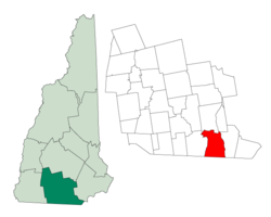
 Location in Hillsborough County, New Hampshire |
||
| Coordinates: 42°45′27″N 71°27′52″W / 42.75750°N 71.46444°WCoordinates: 42°45′27″N 71°27′52″W / 42.75750°N 71.46444°W | ||
| Country | United States | |
| State | New Hampshire | |
| County | Hillsborough | |
| Settled | 1655 | |
| Town | 1746 | |
| City | 1853 | |
| Government | ||
| • Mayor | Jim Donchess | |
| • Board of Aldermen | June M. Caron Richard A. Dowd Linda Harriott-Gathright Ken Gidge Earnest A. Jette Shoshanna Kelly Patricia Klee Brandon Michael Laws Thomas Lopez Brian S. McCarthy Mary Ann Melizzi-Golja Michael B. O'Brien, Sr. Jan Schmidt David C. Tenzca Lori Wilshire |
|
| Area | ||
| • Total | 31.9 sq mi (82.6 km2) | |
| • Land | 30.8 sq mi (79.9 km2) | |
| • Water | 1.0 sq mi (2.7 km2) 3.25% | |
| Elevation | 151 ft (46 m) | |
| Population (2010) | ||
| • Total | 86,494 | |
| • Estimate (2016) | 87,882 | |
| • Density | 2,849/sq mi (1,099.9/km2) | |
| Time zone | Eastern (UTC-5) | |
| • Summer (DST) | Eastern (UTC-4) | |
| ZIP codes |
|
|
| Area code(s) | 603 | |
| FIPS code | 33-50260 | |
| GNIS feature ID | 0868677 | |
| Website | www |
|
Nashua is a city in Hillsborough County, New Hampshire, United States. As of the 2010 census, Nashua had a total population of 86,494, making it the second-largest city in the state after Manchester. As of 2016 the population had risen to an estimated 87,882.
Built around the now-departed textile industry, in recent decades it has been swept up in southern New Hampshire's economic expansion as part of the Boston region. Nashua was twice named "Best Place to Live in America" in annual surveys by Money magazine. It is the only city to get the No. 1 ranking on two occasions—in 1987 and 1998.
The area was part of a 200-square-mile (520 km2) tract of land in Massachusetts called "Dunstable", which had been awarded to Edward Tyng of Dunstable, England. Nashua lies approximately in the center of the original 1673 grant. In 1732, Dunstable was split along the Merrimack River, with the town of Nottingham (now the town of Hudson, New Hampshire) created out of the eastern portion. The previously disputed boundary between Massachusetts and New Hampshire was fixed in 1741 when the governorships of the two provinces were separated. As a consequence, the township of Dunstable was divided in two. Tyngsborough and some of Dunstable remained in Massachusetts, while Dunstable, New Hampshire, was incorporated in 1746 from the northern section of the town.
Located at the confluence of the Nashua and Merrimack rivers, Dunstable was first settled about 1654 as a fur trading town. Like many 19th century riverfront New England communities, it would be developed during the Industrial Revolution with textile mills operated from water power. By 1836, the Nashua Manufacturing Company had built three cotton mills which produced 9.3 million yards of cloth annually on 710 looms. On December 31, 1836, the New Hampshire half of Dunstable was renamed "Nashua", after the Nashua River, by a declaration of the New Hampshire legislature (the Dunstable name lives on across the Massachusetts border). The Nashua River was named by the Nashuway Indians, and in the Penacook language it means "beautiful stream with a pebbly bottom", with an alternative meaning of "land between two rivers". In 1842 the town split again in two for eleven years following a dispute between the area north of the Nashua, and the area south of the river. During that time the northern area (today "French Hill") called itself "Nashville", while the southern part kept the name Nashua. They reconciled in 1853 and joined together to charter the "city of Nashua". Six railroad lines crossed the mill town, namely the Boston, Lowell and Nashua; Worcester and Nashua; Nashua and Acton; Nashua and Wilton; Concord and Nashua; and Rochester railroads; with 56 trains entering and departing daily in the years before the Civil War. These various railroads led to all sections of the country, north, east, south, and west. The Jackson Manufacturing Company employed hundreds of workers in the 1870s.
...
Wikipedia

