Elba (town), New York
| Elba, New York | |
|---|---|
| Town | |
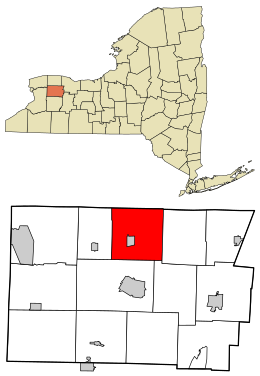
 Location in Genesee County and the state of New York |
|
| Coordinates: 43°04′36″N 78°11′20″W / 43.07667°N 78.18889°WCoordinates: 43°04′36″N 78°11′20″W / 43.07667°N 78.18889°W | |
| Country | United States |
| State | New York |
| County | Genesee |
| Government | |
| • Type | Town council |
| • Town supervisor | Donna Hynes |
| • Town council |
Members
|
| Area | |
| • Total | 35.69 sq mi (92.44 km2) |
| • Land | 35.65 sq mi (92.33 km2) |
| • Water | 0.04 sq mi (0.11 km2) |
| Population (2010) | |
| • Total | 2,370 |
| • Estimate (2016) | 2,300 |
| • Density | 64.52/sq mi (24.91/km2) |
| Time zone | Eastern (EST) (UTC-5) |
| • Summer (DST) | EDT (UTC-4) |
| FIPS code | 36-037-23756 |
Elba is a town in Genesee County, New York, United States. The population was 2,370 at the 2010 census. The town is at the north border of the county and is north of the city of Batavia. The town contains the village of Elba, located near the town's center.
The area was first settled in 1803. The town of Elba was established in 1820, from a partition of the town of Batavia. In 1842, part of Elba was used to form the town of Oakfield.
In 1884, the community of Elba set itself off from the town by incorporating as a village.
According to the United States Census Bureau, the town has a total area of 35.7 square miles (92.5 km²), all of it land.
The north town line is the border of Orleans County (town of Barre).
Part of the Alabama Swamp is in the northwest corner of the town, through which flows Oak Orchard Creek.
North-South NYS 98 and east-west NYS 262 intersect in Elba village.
USGS maps of the area name the section including Ridge Road as "Bulgary Ridge". Prior to more recent maps, in 1897 USGS maps, the area was called "Vulgary".
Torrey Farms, one of the largest farms in New York, is located in the town of Elba.
As of the census of 2000, there were 2,439 people, 853 households, and 668 families residing in the town. The population density was 68.3 people per square mile (26.4/km²). There were 910 housing units at an average density of 25.5 per square mile (9.8/km²). The racial makeup of the town was 93.07% White, 1.72% Black or African American, 0.49% Native American, 0.08% Asian, 3.90% from other races, and 0.74% from two or more races. Hispanic or Latino of any race were 5.25% of the population.
...
Wikipedia
