El Tajín National Airport
|
El Tajín International Airport Aeropuerto Nacional El Tajín |
|||||||||||
|---|---|---|---|---|---|---|---|---|---|---|---|
 |
|||||||||||
| Summary | |||||||||||
| Airport type | Public | ||||||||||
| Operator | Aeropuertos y Servicios Auxiliares | ||||||||||
| Serves | Poza Rica, Veracruz | ||||||||||
| Location | Tihuatlán, Veracruz | ||||||||||
| Elevation AMSL | 497 ft / 151 m | ||||||||||
| Coordinates | 20°36′09″N 97°27′39″W / 20.60250°N 97.46083°W | ||||||||||
| Map | |||||||||||
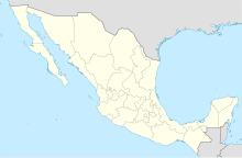
| Location of airport in Mexico | |||||||||||
| Runways | |||||||||||
|
|||||||||||
| Statistics (2016) | |||||||||||
|
|||||||||||
|
Source: Aeropuertos y Servicios Auxiliares
|
|||||||||||
| Total Passengers | 37,613 |
|---|
El Tajín National Airport (IATA: PAZ, ICAO: MMPA) is an international airport located in Tihuatlán, Veracruz, Mexico, near Poza Rica. The airport is named after the archeological site of El Tajín. It handles commercial air traffic for the cities of Poza Rica and Túxpam. Aeropuertos y Servicios Auxiliares, a federal government-owned corporation, operates the airport.
In 2015, the airport handled 60,575 passengers, and in 2016 it handled 37,613 passengers.
...
Wikipedia

