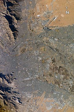
El Paso-Juarez
| El Paso–Juárez Metropolitan Area | |
|---|---|
| Metropolitan Area | |
 |
|
| Nickname(s): Paso del Norte | |
| Coordinates: 31°44′22″N 106°29′13″W / 31.73944°N 106.48694°WCoordinates: 31°44′22″N 106°29′13″W / 31.73944°N 106.48694°W | |
| Countries | United States, Mexico |
| States | Texas, Chihuahua, New Mexico |
| Population | |
| • Total | 2.7 million |
| Time zone | Mountain Standard Time (UTC-7) |
| • Summer (DST) | Mountain Daylight Time (UTC-6) |
| Ciudad Juárez | ||||||||||||||||||||||||||||||||||||||||||||||||||||||||||||
|---|---|---|---|---|---|---|---|---|---|---|---|---|---|---|---|---|---|---|---|---|---|---|---|---|---|---|---|---|---|---|---|---|---|---|---|---|---|---|---|---|---|---|---|---|---|---|---|---|---|---|---|---|---|---|---|---|---|---|---|---|
| Climate chart () | ||||||||||||||||||||||||||||||||||||||||||||||||||||||||||||
|
||||||||||||||||||||||||||||||||||||||||||||||||||||||||||||
|
||||||||||||||||||||||||||||||||||||||||||||||||||||||||||||
| J | F | M | A | M | J | J | A | S | O | N | D |
|
0.7
14
0
|
1
17
2
|
0.9
20
5
|
0.4
24
8
|
0.5
29
12
|
0.7
32
16
|
5.5
31
18
|
4.4
30
17
|
1.9
29
14
|
1.1
25
9
|
1
19
4
|
1.2
14
1
|
| Average max. and min. temperatures in °C | |||||||||||
| Precipitation totals in mm | |||||||||||
| Source: [1] (2010-02-18),INEGI, 2006 report | |||||||||||
| Imperial conversion | |||||||||||
|---|---|---|---|---|---|---|---|---|---|---|---|
| J | F | M | A | M | J | J | A | S | O | N | D |
|
0
57
32
|
0
63
36
|
0
68
41
|
0
75
46
|
0
84
54
|
0
90
61
|
0.2
88
64
|
0.2
86
63
|
0.1
84
57
|
0
77
48
|
0
66
39
|
0
57
34
|
| Wikipedia | |||||||||||

