El Dorado, Kansas
| El Dorado, Kansas | |
|---|---|
| City | |

Main & Pine in El Dorado (2012)
|
|
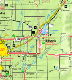
 Location within Butler County and Kansas |
|
 KDOT map of Butler County (legend) |
|
| Coordinates: 37°49′16″N 96°51′30″W / 37.82111°N 96.85833°WCoordinates: 37°49′16″N 96°51′30″W / 37.82111°N 96.85833°W | |
| Country | United States |
| State | Kansas |
| County | Butler |
| Incorporated | 1871 |
| Government | |
| • Mayor | Vince Haines |
| Area | |
| • Total | 8.92 sq mi (23.10 km2) |
| • Land | 8.86 sq mi (22.95 km2) |
| • Water | 0.06 sq mi (0.16 km2) 0.67% |
| Elevation | 1,342 ft (409 m) |
| Population (2010) | |
| • Total | 13,021 |
| • Estimate (2015) | 12,931 |
| • Density | 1,500/sq mi (560/km2) |
| Time zone | CST (UTC-6) |
| • Summer (DST) | CDT (UTC-5) |
| ZIP code | 67042 |
| Area code | 316 |
| FIPS code | 20-20075 |
| GNIS feature ID | 0485449 |
| Website | EldoKS.com |
El Dorado (![]() i/ˌɛldəˈreɪdoʊ/EL-də-RAY-doh) is city and county seat of Butler County, Kansas, United States. It is situated along the Walnut River in the central part of Butler County and located in south-central Kansas. As of the 2010 census, the city population was 13,021.
i/ˌɛldəˈreɪdoʊ/EL-də-RAY-doh) is city and county seat of Butler County, Kansas, United States. It is situated along the Walnut River in the central part of Butler County and located in south-central Kansas. As of the 2010 census, the city population was 13,021.
El Dorado was laid out and platted in 1868. The name is of Spanish origin meaning "golden land". El Dorado was incorporated in 1870.
In 1877, the Florence, El Dorado, and Walnut Valley Railroad Company built a branch line from Florence to El Dorado; in 1881 it was extended to Douglass, and later to Arkansas City. The line was leased and operated by the Atchison, Topeka and Santa Fe Railway. The line from Florence to El Dorado was abandoned in 1942. The original branch line connected Florence, Burns, De Graff, El Dorado, Augusta, Douglass, Rock, Akron, Winfield, and Arkansas City.
...
Wikipedia
