Augusta, Kansas
| Augusta, Kansas | |
|---|---|
| City | |
 Location within Butler County and Kansas |
|
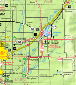
 KDOT map of Butler County (legend) |
|
| Coordinates: 37°41′33″N 96°58′48″W / 37.69250°N 96.98000°WCoordinates: 37°41′33″N 96°58′48″W / 37.69250°N 96.98000°W | |
| Country | United States |
| State | Kansas |
| County | Butler |
| Established | 1868 |
| Government | |
| • Mayor | Matt Childers |
| • City Manager | Josh Shaw |
| Area | |
| • Total | 4.75 sq mi (12.30 km2) |
| • Land | 4.23 sq mi (10.96 km2) |
| • Water | 0.52 sq mi (1.35 km2) |
| Elevation | 1,276 ft (389 m) |
| Population (2010) | |
| • Total | 9,274 |
| • Estimate (2015) | 9,299 |
| • Density | 2,000/sq mi (750/km2) |
| Time zone | Central (CST) (UTC-6) |
| • Summer (DST) | CDT (UTC-5) |
| ZIP code | 67010 |
| Area code | 316 |
| FIPS code | 20-03300 |
| GNIS feature ID | 0474806 |
| Website | augustaks.org |
Augusta is a city in Butler County, Kansas, United States. As of the 2010 census, the city population was 9,274.
The confluence of the Whitewater River and the Walnut River was originally inhabited by Osage people, who found the land ideal for hunting and fishing.
In 1868, C. N. James settled in the area and built a log cabin to serve also as a general store and trading post. Around that same time, a post office was established in the settlement, and as the first postmaster, C. N. James named the post office and the town in honor of his wife, Augusta James.
In 1877, the Florence, El Dorado, and Walnut Valley Railroad Company built a branch line from Florence to El Dorado. In 1881 it was extended to Douglass, and later to Arkansas City. The rail line was leased and operated by the Atchison, Topeka and Santa Fe Railway. Service from Florence to El Dorado was abandoned in 1942. The original branch line connected Florence, Burns, De Graff, El Dorado, Augusta, Douglass, Rock, Akron, Winfield, Arkansas City.
...
Wikipedia
