El Camino Real de los Tejas National Historic Trail
| El Camino Real de los Tejas National Historic Trail | |
|---|---|

Location of trail
|
|
| Location | Texas, Louisiana; USA |
| Nearest city | (start) & Laredo, TX |
| Established | 2004 |
| Governing body | National Park Service |
| Website | El Camino Real de los Tejas National Historic Trail |
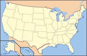
The El Camino Real de los Tejas National Historic Trail is a National Historic Trail covering the U.S. section of the El Camino Real de Los Tejas, a thoroughfare from the 18th-century Spanish colonial era in Spanish Texas instrumental in the settlement, development and history of Texas. The National Park Service designated the El Camino Real de los Tejas National Historic Trail as a unit in the National Historic Trail system in 2004.
The modern highways Texas 21 (along with Texas OSR) and Louisiana 6 roughly follow the original route of the trail.
Alonso de León, Spanish governor of Coahuila established the corridor for what would become the El Camino Real de los Tejas in multiple expeditions to East Texas between 1686 and 1690 to find and destroy a French fort established by René-Robert Cavelier, Sieur de La Salle on what de León considered to be Spanish lands. The route would be refined in 1691-1692 by Domingo Terán de los Ríos, the first governor of Spanish Texas, in an effort to make better connections to the Spanish missions in East Texas. San Antonio de Bexar, founded in 1718, was the first of many communities built as way stations on the trail.
After Mexico achieved independence from Spain in 1821, immigrants from the American colonies invited to Texas would use the corridor to travel to their settlements. A section of the road called Camino Arriba by the Spanish became known as the Old San Antonio Road. The growth of towns such as Austin, Galveston and Houston not on the original route along with the building of railroads changed the direction of travel and trade and the use of El Camino Real de los Tejas diminished.
...
Wikipedia
