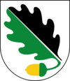
Ekerö Municipality
| Ekerö kommun | ||
|---|---|---|
| Municipality | ||
|
||
| Country | Sweden | |
| County | ||
| Seat | Ekerö | |
| Area | ||
| • Total | 383.61 km2 (148.11 sq mi) | |
| • Land | 217.68 km2 (84.05 sq mi) | |
| • Water | 165.93 km2 (64.07 sq mi) | |
| Area as of January 1, 2014. | ||
| Population (December 31, 2016) | ||
| • Total | 27,406 | |
| • Density | 71/km2 (190/sq mi) | |
| Time zone | CET (UTC+1) | |
| • Summer (DST) | CEST (UTC+2) | |
| ISO 3166 code | SE | |
| Province | Uppland | |
| Municipal code | 0125 | |
| Website | www.ekero.se | |
| Density is calculated using land area only. | ||
Ekerö Municipality (Swedish: Ekerö kommun) is a municipality in the province of Uppland in in east central Sweden. The name derives from the name of the main island within the municipality whose name is Ekerön, and literally means "Oak Island". Its seat is located in the town of Ekerö.
Even if the is the official capital of Sweden, the king of Sweden actually lives in Ekerö Municipality, at Drottningholm Palace (see below).
Ekerö is the only municipality in the Lake Mälaren region composed exclusively of islands. Land elevation has reduced the number of islands and skerries to 140, the largest of which, distinguished on the map below, are Adelsö, Munsö, Ekerö, Färingsö, and Lovö. 2000 years ago, during the Roman Iron Age, Färingsön was more of an archipelago of twenty islands.
Originally, when the first local government acts were implemented in Sweden in 1863, eight rural municipalities were created, each corresponding to an old parish. The municipal reform of 1952 grouped them in two new larger entities. The next reform in 1971 merged them into the present municipality.
The municipality contains two UNESCO World Heritage Sites. One is Birka, an old Viking Age village, and the other is Drottningholm Palace and its surroundings.
...
Wikipedia

