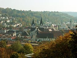
Eichstätt
| Eichstätt | ||
|---|---|---|

Eichstätt
|
||
|
||
| Coordinates: 48°53′31″N 11°11′2″E / 48.89194°N 11.18389°ECoordinates: 48°53′31″N 11°11′2″E / 48.89194°N 11.18389°E | ||
| Country | Germany | |
| State | Bavaria | |
| Admin. region | Oberbayern | |
| District | Eichstätt | |
| Government | ||
| • Lord Mayor | Andreas Steppberger (FW) | |
| Area | ||
| • Total | 47.78 km2 (18.45 sq mi) | |
| Elevation | 393 m (1,289 ft) | |
| Population (2015-12-31) | ||
| • Total | 13,407 | |
| • Density | 280/km2 (730/sq mi) | |
| Time zone | CET/CEST (UTC+1/+2) | |
| Postal codes | 85071, 85072, 85067 | |
| Dialling codes | 08421 | |
| Vehicle registration | EI | |
| Website | www.eichstaett.de | |
Eichstätt (German pronunciation: [ˈaɪçʃtɛt], formerly also Eichstädt or Aichstädt) is a town in the federal state of Bavaria, Germany, and capital of the district of Eichstätt. It is located on the Altmühl river and has a population of around 13,000. Eichstätt is also the seat of the Roman Catholic Diocese of Eichstätt.
Eichstätt lies on both sides of the river Altmühl in the district of Eichstätt of the Oberbayern region of Bavaria.
Eichstätt is located at an outlying spur of the Franconian Jura and is famous for the quarries of Solnhofen Plattenkalk (Jurassic limestone). On the Blumenberg the Berlin specimen of Archaeopteryx was found by Jakob Niemeyer.
St. Willibald founded the Diocese of Eichstätt on the site of an old Roman station in 741. The city was chartered in 908. It was ruled by a prince-bishop, and in the Holy Roman Empire was the seat of the Bishopric of Eichstätt until secularization in 1802. In 1806, it became a part of the Kingdom of Bavaria. Eichstätt was included as part of the Principality of Eichstätt, which King Maximilian I granted to his son-in-law Eugène de Beauharnais in 1817 and an episcopal see was reestablished in 1821.
...
Wikipedia


