Eel River (Wabash River)
| Eel River (Kenapocomoco) | |
| L'Anguille River | |
| River | |
|
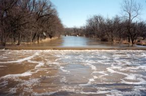
Collamer Dam
|
|
| Country | United States |
|---|---|
| State | Indiana |
| Source | |
| - location | Huntertown, Indiana |
| Mouth | Wabash River |
| - location | Logansport, Indiana |
The Eel River is a 94-mile-long (151 km) tributary of the Wabash River in northern Indiana in the United States. Via the Wabash and Ohio rivers, its waters flow to the Mississippi River and ultimately the Gulf of Mexico. The Eel River rises southeast of Huntertown in Allen County and flows southwest through Allen, Whitley, Kosciusko, Wabash, Miami, and Cass counties to join the Wabash at Logansport. The river was called Ke-na-po-co-mo-co by the Miami people, who inhabited the area at the time of European contact.
Originating as an "ice-marginal channel" at the edge of the retreating Saginaw Lobe of the Wisconsin Glacier, the Eel River was later buried by the glacier's advancing Erie Lobe. As the Erie Lobe retreated, the Eel formed a single stream with what is now upper Cedar Creek in DeKalb and Allen counties. The ancestral Eel River was also fed by glacial meltwater surging under the ice from the southeast through a "tunnel valley" known today as Cedar Creek Canyon. Blockage of the Eel's channel by outwash from the canyon and a decline in the volume of meltwater forced the upper Eel to change course into the canyon, creating today's Cedar Creek. This is a classic example of stream piracy that shifted almost 175,000 acres (710 km2) of land from the Eel-Wabash watershed to that of the St. Joseph-Maumee.
...
Wikipedia

