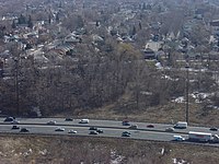
East York, Toronto
| East York, Toronto | ||
|---|---|---|
| Dissolved municipality | ||

East York in 2005
|
||
|
||
 Location of East York (red) compared to the rest of Toronto. |
||
| Coordinates: 43°41′28.68″N 79°19′40.08″W / 43.6913000°N 79.3278000°WCoordinates: 43°41′28.68″N 79°19′40.08″W / 43.6913000°N 79.3278000°W | ||
| Country |
|
|
| Province |
|
|
| Municipality |
|
|
| Incorporated | January 1, 1924 (Township) January 1, 1967 (Borough) |
|
| Changed Region | 1953 |
|
| Amalgamated | January 1, 1998 into Toronto | |
| Government | ||
| • Councillors |
Janet Davis Mary Fragedakis John Parker |
|
| • Governing Body | Toronto City Council | |
| • MPs |
Julie Dabrusin (Liberal) Nathaniel Erskine-Smith (Liberal) Rob Oliphant (Liberal) |
|
| • MPPs |
Arthur Potts (LIB) Peter Tabuns (NDP) Kathleen Wynne (LIB) |
|
| Area | ||
| • Total | 21.26 km2 (8.21 sq mi) | |
| Population (2016) | ||
| • Total | 118,071 | |
| • Density | 5,553.7/km2 (14,384/sq mi) | |
| Time zone | EST (UTC-5) | |
| • Summer (DST) | EDT (UTC-4) | |
| Postal code span | M4B, M4C, M4E, M4G, M4H, M4J | |
East York is a former municipality within the City of Toronto, Ontario, Canada. It was a semi-autonomous borough within the overall municipality of Metropolitan Toronto until 1998, when it was amalgamated into the new "megacity" of Toronto. Before the amalgamation, it was Canada's only borough.
It is separated by the Don River from the former City of Toronto. Traditional East York is southeast of the river, and the neighbourhoods of Leaside, Bennington Heights and densely populated Thorncliffe Park are northwest of the river. The heart of East York is filled with middle-class and working-class homes, with extensive high-rise developments along peripheral major streets and in Crescent Town and Thorncliffe Park.
East York was originally part of York Township. Following the incorporation of the Township of North York in 1922, York Township was divided by Toronto, Leaside and North Toronto. With the rapid growth that followed the opening of the Bloor-Danforth (Prince Edward) Viaduct in 1919, the residents of the eastern half of York Township (as an exclave of the western half) felt they had been neglected by the township when it came to roads, sewers and other municipal services. Left with the option to either join the City of Toronto or branch out on its own, 448 East Yorkers voted to incorporate a new township, while 102 voted to amalgamate with Toronto. The Township of East York was incorporated on January 1, 1924 with a population of 19,849. The western half of York Township retained its name.
East York was originally populated by working class English people who valued the opportunity to own small homes of their own, with front lawns and back gardens. Many had immigrated from Lancashire and Yorkshire. In 1961, 71.7% of the population identified themselves as having British origins.
...
Wikipedia

