East Vincent
| East Vincent Township | |
|---|---|
| Township | |

|
|
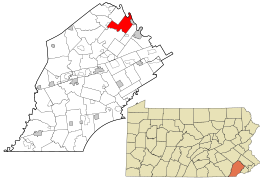
 Location in Chester County and the state of Pennsylvania. |
|
 Location of Pennsylvania in the United States |
|
| Coordinates: 40°10′26″N 75°37′59″W / 40.17389°N 75.63306°WCoordinates: 40°10′26″N 75°37′59″W / 40.17389°N 75.63306°W | |
| Country | United States |
| State | Pennsylvania |
| County | Chester |
| Area | |
| • Total | 13.7 sq mi (35 km2) |
| • Land | 13.5 sq mi (35 km2) |
| • Water | 0.2 sq mi (0.5 km2) |
| Elevation | 390 ft (120 m) |
| Population (2010) | |
| • Total | 6,821 |
| • Estimate (2016) | 7,031 |
| • Density | 497.9/sq mi (192.2/km2) |
| Time zone | EST (UTC-5) |
| • Summer (DST) | EDT (UTC-4) |
| Area code(s) | 610 |
| FIPS code | 42-029-22000 |
| Website | www |
East Vincent Township is a township in Chester County, Pennsylvania, United States. The population was 6,821 at the 2010 census.
According to the United States Census Bureau, the township has a total area of 13.7 square miles (35 km2), of which, 13.5 square miles (35 km2) of it is land and 0.2 square miles (0.52 km2) of it (1.10%) is water. The township is partially located in the Hopewell Big Woods.
In 1686, Dr. Daniel Coxe received a land patent from William Penn. Him and Major Robert Thompson owned what is now East and West Vincent. In 1733, the German Reformed Congregation of Vincent Township was formed. Two years later, in 1735, the Vincent Mennonite Meeting was formed. In that same year, Garrett Brumbaugh established a tavern on Ridge Road. Nicholas Kaiser would soon open a grist mill near the mouth of Pigeon Creek in 1737, and so began the forming of East Vincent. However, nine years later in 1746, all lands in Vincent were leased and were not available for sale, because of a land dispute. There were 46 renters. In 1754, another tavern opened up along Ridge Road, courtesy of Michael Cyfer. Today, the tavern is known for being the well-known, reportedly haunted restaurant Seven Stars Inn. Four years later, the German Reformation Congregation constructed a log church, which was dedicated May 27. John Phillips Leydich served as the first pastor of the facility. Today, the ground is site to the East Vincent United Church of Christ. Around 1760, John Young built a house on Cooks Glen Road which still stands today, and is known for being one of the oldest houses in the area. The 1760s brought about a boom of development to the area, with Peter Stager and Edward Parker opening up establishments. The former's erection was named the Benjamin Custard Inn on Schuylkill Road. Today it is the White Hall Inn. The latter's was a tavern near a ford on the Schuylkill River. They both opened in 1768. During the Revolutionary War, George Washington and his troops forded the Schuylkill River behind the Parker Tavern. Between 1786 and 1790, a hundred-year-long dispute was settled in the courts, allowing property to finally be sold. By this time, there were 90 renters and a total population of 430. In 1800, Frederick Sheeder moved to East Vincent. A year later, Henry Parker built a house opposite the tavern that bore his name. In 1821, a tragedy struck East Vincent when the German Reformed Church split because of temperance caused by revival meetings. Just that year, John C. Guldin had become the 5th pastor of the church. Between 1823 and 1824, the township gained morale, as the SNC (Schuylkill Navigation Company) built dams, lakes, and canals to carry water between Pottsville and Philadelphia, decreasing hardship in Vincent. In 1831, a wall was built along the Revolutionary War Soldiers' Cemetery by the Union Battalion of Volunteers of Chester County, dedicated to the brave men who gave their lives to help shape the nation. In 1832, joyfulness became clear as the battle was won: East and West Vincent were divided along the French Creek. The Kennedy Bridge, Parker's Ford, and Vincent Forge Mansion are listed on the National Register of Historic Places.
...
Wikipedia
