East Saint Louis
| East St. Louis, Illinois | |
| City | |
| Country | United States |
|---|---|
| State | Illinois |
| County | St. Clair |
| Coordinates | 38°37′N 90°8′W / 38.617°N 90.133°WCoordinates: 38°37′N 90°8′W / 38.617°N 90.133°W |
| Area | 14.37 sq mi (37.22 km2) |
| - land | 13.99 sq mi (36 km2) |
| - water | 0.38 sq mi (1 km2), 2.64% |
| Population | 27,006 (2010) |
| Density | 1,929/sq mi (744.8/km2) |
| Founded | June 6, 1820 |
| - Incorporated | February 16, 1865 |
| Government | Council-Manager |
| Mayor | Emeka Jackson-Hicks |
| Timezone | CST (UTC-6) |
| - summer (DST) | CDT (UTC-5) |
| Postal code | 62201–62207 |
| Area code | 618 |
|
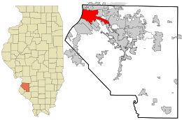
Location in St. Clair County and the state of Illinois.
|
|
|
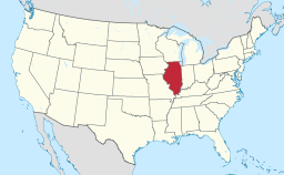
Location of Illinois in the United States
|
|
| Website: www.cesl.us | |
East St. Louis is a city in St. Clair County, Illinois, United States, directly across the Mississippi River from St. Louis, Missouri, in the Metro-East region of Southern Illinois. As of the 2010 census, the city had a total population of 27,006, less than one-third of its peak of 82,366 in 1950. Like many larger industrial cities, it has been severely affected by loss of jobs in the restructuring of the railroad industry and de-industrialization of the Rust Belt in the second half of the 20th century. In 1950, East St. Louis was the fourth largest city in Illinois.
One of the highlights of the city's waterfront is the Gateway Geyser, the second-tallest fountain in the world. Designed to complement the Gateway Arch across the river in St. Louis, it shoots water to a height of 630 feet (190 m), the same height as the Arch.
Native Americans had long inhabited both sides of the Mississippi River. The Mississippian culture rulers organized thousands of workers to construct villages and complex earthwork mounds at what later became St. Louis and East St. Louis, as well as the urban complex of Cahokia to the north of East St. Louis within present-day Collinsville, Illinois. Before the Civil War, settlers reported up to 50 mounds in the area that became East St. Louis, but most were lost to 19th-century development and later roadbuilding.
East St. Louis lies within the American Bottom area of the present day Metro-East area of St. Louis, Missouri. This name was given after the United States acquired the Louisiana Purchase in 1803, and European Americans began to settle in the area. The village was first named "Illinoistown".
...
Wikipedia


