East Oakland Township, Coles County, Illinois
| East Oakland Township | |
|---|---|
| Township | |
 Location in Coles County |
|
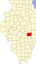
 Coles County's location in Illinois |
|
| Coordinates: 39°38′N 88°1′W / 39.633°N 88.017°WCoordinates: 39°38′N 88°1′W / 39.633°N 88.017°W | |
| Country | United States |
| State | Illinois |
| County | Coles |
| Established | November 8, 1859 |
| Area | |
| • Total | 39.33 sq mi (101.9 km2) |
| • Land | 39.25 sq mi (101.7 km2) |
| • Water | 0.08 sq mi (0.2 km2) 0.20% |
| Elevation | 659 ft (201 m) |
| Population (2010) | |
| • Estimate (2016) | 1,369 |
| • Density | 35.4/sq mi (13.7/km2) |
| Time zone | CST (UTC-6) |
| • Summer (DST) | CDT (UTC-5) |
| ZIP codes | 61912, 61943 |
| FIPS code | 17-029-22138 |
East Oakland Township is one of twelve townships in Coles County, Illinois, USA. As of the 2010 census, its population was 1,388 and it contained 663 housing units. The township changed its name from Oakland Township on May 7, 1860.
According to the 2010 census, the township has a total area of 39.33 square miles (101.9 km2), of which 39.25 square miles (101.7 km2) (or 99.80%) is land and 0.08 square miles (0.21 km2) (or 0.20%) is water.
The township contains six cemeteries: Bell, Berry, Fairview, Oak Grove, Rosedale and Shields.
...
Wikipedia
