East Newark, New Jersey
| East Newark, New Jersey | |
|---|---|
| Borough | |
| Borough of East Newark | |

Erie-Lackawanna embankment
|
|
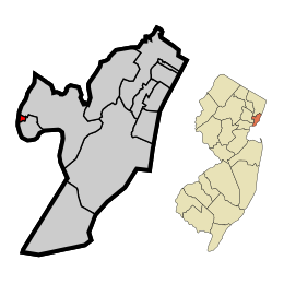
 Map highlighting East Newark within Hudson County. Inset: Location of Hudson County highlighted in the State of New Jersey. |
|
 Census Bureau map of East Newark, New Jersey |
|
| Coordinates: 40°45′07″N 74°09′44″W / 40.751965°N 74.162202°WCoordinates: 40°45′07″N 74°09′44″W / 40.751965°N 74.162202°W | |
| Country | |
| State |
|
| County | Hudson |
| Incorporated | July 3, 1895 |
| Government | |
| • Type | Borough |
| • Body | Borough Council |
| • Mayor | Joseph R. Smith (D, term ends December 31, 2019) |
| • Clerk | Robert B. Knapp |
| Area | |
| • Total | 0.123 sq mi (0.320 km2) |
| • Land | 0.102 sq mi (0.265 km2) |
| • Water | 0.021 sq mi (0.055 km2) 17.13% |
| Area rank | 565th of 566 in state 12th of 12 in county |
| Elevation | 16 ft (5 m) |
| Population (2010 Census) | |
| • Total | 2,406 |
| • Estimate (2015) | 2,665 |
| • Rank | 474th of 566 in state 12th of 12 in county |
| • Density | 23,532.1/sq mi (9,085.8/km2) |
| • Density rank | 6th of 566 in state 5th of 12 in county |
| Time zone | Eastern (EST) (UTC-5) |
| • Summer (DST) | Eastern (EDT) (UTC-4) |
| ZIP code | 07029 |
| Area code(s) | 973 |
| FIPS code | 3401719360 |
| GNIS feature ID | 0885199 |
| Website | www |
East Newark is a borough in Hudson County, New Jersey, United States. It's a suburb of the nearby city of Newark.
The Borough of East Newark was established on July 3, 1895, from portions of Kearny lying between the Erie Railroad's Newark Branch right of way and Harrison, based on the results of a referendum held the previous day.
As of the 2010 United States Census, the borough's population was 2,406, reflecting an increase of 29 (+1.2%) from the 2,377 counted in the 2000 Census, which had in turn increased by 220 (+10.2%) from the 2,157 counted in the 1990 Census.
According to the United States Census Bureau, the borough had a total area of 0.123 square miles (0.320 km2), including 0.102 square miles (0.265 km2) of land and 0.021 square miles (0.055 km2) of water (17.13%).
The borough is bordered on the west by Newark, on the north by Kearny, and on the south and east by Harrison.
The 2010 United States Census counted 2,406 people, 759 households, and 569.3 families residing in the borough. The population density was 23,532.1 per square mile (9,085.8/km2). The borough contained 794 housing units at an average density of 7,765.8 per square mile (2,998.4/km2). The racial makeup of the borough was 63.01% (1,516) White, 1.91% (46) Black or African American, 0.42% (10) Native American, 7.81% (188) Asian, 0.04% (1) Pacific Islander, 22.90% (551) from other races, and 3.91% (94) from two or more races. Hispanics or Latinos of any race were 61.39% (1,477) of the population.
...
Wikipedia
