East Moline
| East Moline | |
|---|---|
| City | |
 |
|
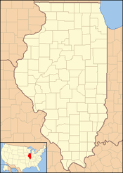
 Location of East Moline in Rock Island County, Illinois. |
|
| Location in the state of Illinois | |
| Coordinates: 41°30′43″N 90°26′07″W / 41.51194°N 90.43528°WCoordinates: 41°30′43″N 90°26′07″W / 41.51194°N 90.43528°W | |
| Country | United States |
| State | Illinois |
| County | Rock Island County |
| Incorporated | 1903 |
| Government | |
| • Mayor | Reggi Freeman |
| Area | |
| • City | 14.56 sq mi (37.71 km2) |
| • Land | 14.56 sq mi (37.71 km2) |
| • Water | 0.00 sq mi (0.00 km2) |
| Elevation | 577 ft (176 m) |
| Population (2010) | |
| • City | 21,302 |
| • Estimate (2016) | 21,135 |
| • Density | 1,451.68/sq mi (560.49/km2) |
| • Metro | 381,342 (134th) |
| Time zone | CST (UTC-6) |
| • Summer (DST) | CDT (UTC-5) |
| FIPS code | 17-22073 |
| Interstates | I-74, I-80, I-88, and I-280 |
| Website | www |
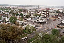
East Moline is a city in Rock Island County, Illinois, United States. The population was 21,302 at the 2010 census. East Moline is one of the five Quad Cities, along with the cities of Rock Island, Moline, and the Iowa cities of Davenport and Bettendorf. The Quad Cities has a population estimate of 381,342.
According to the 2010 census, East Moline has a total area of 14.76 square miles (38.23 km2), all land.
East Moline is located at 41°30′43″N 90°26′7″W / 41.51194°N 90.43528°W (41.511940, −90.435203).
As of the United States Census taken in 2000, there were 20,333 people, 8,510 households, and 5,369 families residing in the city. The population density was 2,254.9 people per square mile (870.4/km²). There were 8,988 housing units at an average density of 996.7 per square mile (384.7/km²). The racial makeup of the city was 80.04% White, 7.34% African American, 0.35% Native American, 2.25% Asian, 7.47% from other races, and 2.54% from two or more races. Hispanic or Latino of any race were 15.15% of the population.
...
Wikipedia

