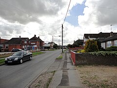
Durrington, Wiltshire
| Durrington | |
|---|---|
 |
|
| Durrington shown within Wiltshire | |
| Population | 7,379 (in 2011, includes Larkhill) |
| OS grid reference | SU158444 |
| Civil parish |
|
| Unitary authority | |
| Ceremonial county | |
| Region | |
| Country | England |
| Sovereign state | United Kingdom |
| Post town | Salisbury |
| Postcode district | SP4 |
| Dialling code | 01980 |
| Police | Wiltshire |
| Fire | Dorset and Wiltshire |
| Ambulance | South Western |
| EU Parliament | South West England |
| UK Parliament | |
| Website | Town Council |
Durrington is a village and civil parish in Wiltshire, England. The village lies about 2 miles (3.2 km) north of the town of Amesbury, 10 miles (16 km) north of the city of Salisbury, and 2 1⁄2 miles (4.0 km) northeast of the Stonehenge monument. It is on the eastern part of Salisbury Plain, the largest remaining area of chalk grassland in northwest Europe. The parish includes the hamlet of Hackthorn, on the northern outskirts of Durrington, and the military settlement of Larkhill, 1.5 miles (2.4 km) to the west.
Durrington has a long history, dating back to the Neolithic era. Two ancient sites lie in the parish: Durrington Walls and Woodhenge. The parish is in the Upper Avon valley, with the River Avon forming its eastern boundary; Durrington village is close to the river. The toponym is derived from the Old English Deor ingtūn, meaning 'farm or settlement connected with Deor', Deor being a personal name.
The village's population of about 5,000 is served by several shops, two pubs, schools covering all levels of compulsory education, and a swimming pool and fitness centre.
The area had been occupied since Neolithic times but not necessarily continuously. The parish contains two important Neolithic sites: Durrington Walls and Woodhenge. Recent archaeological excavations indicate that the Neolithic inhabitants of the village kept a large number of pigs, with bone evidence suggesting that the pigs were unusually large for the time. This may be because inhabitants fattened them up to sell them to visitors to nearby Stonehenge.
There is little evidence of Saxon occupation, but this may be because buildings and utensils of that time were made of wood, so little survives. The Domesday Book recorded two estates in 1086, having land for one plough team and with 5 acres (2.0 ha) of meadow. These two estates may represent the later two manors.
...
Wikipedia

