Durham, Maine
| Durham, Maine | |
|---|---|
| Town | |
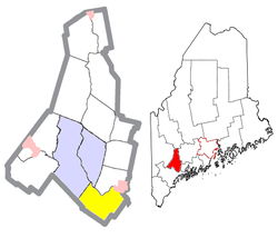
 Location of Durham (in yellow) in Androscoggin County and the state of Maine |
|
| Location in the United States | |
| Coordinates: 43°58′21″N 70°7′23″W / 43.97250°N 70.12306°WCoordinates: 43°58′21″N 70°7′23″W / 43.97250°N 70.12306°W | |
| Country | United States |
| State | Maine |
| County | Androscoggin |
| Incorporation | February 17, 1789 |
| Area | |
| • Total | 39.04 sq mi (101.11 km2) |
| • Land | 38.28 sq mi (99.14 km2) |
| • Water | 0.76 sq mi (1.97 km2) |
| Elevation | 167 ft (51 m) |
| Population (2010) | |
| • Total | 3,848 |
| • Estimate (2012) | 3,886 |
| • Density | 100.5/sq mi (38.8/km2) |
| Time zone | Eastern (EST) (UTC-5) |
| • Summer (DST) | EDT (UTC-4) |
| ZIP code | 04222 |
| Area code(s) | 207 |
| FIPS code | 23-19105 |
| GNIS feature ID | 0582448 |
Durham is a town in Androscoggin County, Maine, United States. The population was 3,848 at the 2010 census. It is included in both the Lewiston-Auburn, Maine Metropolitan Statistical Area and the Lewiston-Auburn, Maine Metropolitan New England City and Town Area.
Durham was named after County Durham, England, the ancestral home of the town's first settler. It was previously known as Royallsborough, named after Isaac Royall Jr..
According to the United States Census Bureau, the town has a total area of 39.04 square miles (101.11 km2), of which 38.28 square miles (99.14 km2) is land and 0.76 square miles (1.97 km2) is water.
Durham is bordered by Pownal, Auburn, Freeport, New Gloucester, Brunswick, Lewiston, Lisbon Falls, and Topsham.
Durham is considered a "gateway" town because it connects two major Maine communities, the Greater Portland Area with the Lewiston–Auburn Area.
As of the census of 2010, there were 3,848 people, 1,496 households, and 1,143 families residing in the town. The population density was 100.5 inhabitants per square mile (38.8/km2). There were 1,548 housing units at an average density of 40.4 per square mile (15.6/km2). The racial makeup of the town was 97.8% White, 0.3% African American, 0.1% Native American, 0.5% Asian, 0.2% from other races, and 1.0% from two or more races. Hispanic or Latino of any race were 0.8% of the population.
...
Wikipedia

