Durham, Connecticut
| Durham, Connecticut | ||
|---|---|---|
| Town | ||

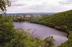
View from Pistapaug Mountain
|
||
|
||
 Location within Middlesex County, Connecticut |
||
| Coordinates: 41°27′37″N 72°40′55″W / 41.46028°N 72.68194°WCoordinates: 41°27′37″N 72°40′55″W / 41.46028°N 72.68194°W | ||
| Country | United States | |
| State | Connecticut | |
| NECTA | New Haven | |
| Region | Midstate Region | |
| Incorporated | 1708 | |
| Government | ||
| • Type | Selectman-town meeting | |
| • First selectman | Laura L. Francis (R) | |
| • Selectman | John T. Szewczyk, Jr. (R) | |
| • Selectman | Dr. Steve Levy (D) | |
| Area | ||
| • Total | 23.8 sq mi (61.6 km2) | |
| • Land | 23.6 sq mi (61.1 km2) | |
| • Water | 0.2 sq mi (0.4 km2) | |
| Elevation | 171 ft (52 m) | |
| Population (2005) | ||
| • Total | 7,388 | |
| • Density | 308/sq mi (119/km2) | |
| Time zone | Eastern (UTC-5) | |
| • Summer (DST) | Eastern (UTC-4) | |
| ZIP code | 06422 | |
| Area code(s) | 860; 959 (future) | |
| FIPS code | 09-20810 | |
| GNIS feature ID | 0213419 | |
| Website | www |
|
Durham is a town in Middlesex County, Connecticut, United States. Durham is a former farming village on the Coginchaug River in central Connecticut. The population was 7,388 at the 2010 census. Every autumn, the town hosts the Durham Fair, the largest volunteer agricultural fair in New England.
The Durham town center is listed by the U.S. Census Bureau as a census-designated place in the 2000 census. The core of the town center has also been listed as a historic district on the National Register of Historic Places.
According to the United States Census Bureau, the town has a total area of 23.8 square miles (62 km2), of which, 23.6 square miles (61 km2) is land and 0.2 square miles (40 ha or 0.67%) is water. The town center CDP has a total area of 6.3 square miles (16 km2). 6.3 square miles (16 km2) of it is land and 0.16% is water.
The west side of Durham is flanked by the Metacomet Ridge, a mountainous trap rock ridgeline that stretches from Long Island Sound to nearly the Vermont border. Notable features of the Metacomet ridge in Durham include Trimountain, Fowler Mountain, Pistapaug Mountain, and the north tip of Totoket Mountain. The 50-mile (80-kilometer) Mattabesett Trail traverses the ridge. Miller's Pond State Park is located within the town.
...
Wikipedia

