Dry Ridge, Kentucky
| Dry Ridge, Kentucky | |
|---|---|
| City | |
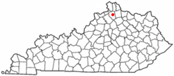
 Location of Dry Ridge, Kentucky |
|
| Coordinates: 38°40′56″N 84°35′47″W / 38.68222°N 84.59639°WCoordinates: 38°40′56″N 84°35′47″W / 38.68222°N 84.59639°W | |
| Country | United States |
| State | Kentucky |
| County | Grant |
| Area | |
| • Total | 4.58 sq mi (11.85 km2) |
| • Land | 4.54 sq mi (11.76 km2) |
| • Water | 0.03 sq mi (0.09 km2) |
| Elevation | 951 ft (290 m) |
| Population (2010) | |
| • Total | 2,191 |
| • Density | 483/sq mi (186.3/km2) |
| Time zone | Eastern (EST) (UTC-5) |
| • Summer (DST) | EDT (UTC-4) |
| ZIP code | 41035 |
| Area code(s) | 859 |
| FIPS code | 21-22582 |
| GNIS feature ID | 0491228 |
| Website | cdrky |
Dry Ridge is a home rule-class city in Grant County, Kentucky, in the United States. The population was 2,191 at the 2010 census, up from 1,995 at the 2000 census.
Dry Ridge is located north of the center of Grant County at 38°40′56″N 84°35′47″W / 38.68222°N 84.59639°W (38.682242, -84.596370). It is bordered to the south by the city of Williamstown, the county seat. Interstate 75 passes through Dry Ridge, with access from Exit 159. I-75 leads north 35 miles (56 km) to Cincinnati and south 49 miles (79 km) to Lexington. U.S. Route 25 (Main Street) runs through the center of Dry Ridge, leading north 7 miles (11 km) to Crittenden and south 4 miles (6 km) to the center of Williamstown.
According to the United States Census Bureau, Dry Ridge has a total area of 4.6 square miles (11.8 km2), of which 0.03 square miles (0.09 km2), or 0.72%, is water.
The community now known as Dry Ridge was settled about 1792 as "Campbell's Station" near a spring said to have medicinal qualities.
A post office called "Dry Ridge" was established in 1815 at an inn. Dry Ridge takes its name from a ridge surrounded by inns where travelers stopped for water before proceeding.
...
Wikipedia
