Doullens
| Doullens | |
|---|---|

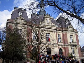
Town hall
|
|
| Coordinates: 50°09′27″N 2°20′29″E / 50.1575°N 2.3414°ECoordinates: 50°09′27″N 2°20′29″E / 50.1575°N 2.3414°E | |
| Country | France |
| Region | Hauts-de-France |
| Department | Somme |
| Arrondissement | Amiens |
| Canton | Doullens |
| Intercommunality | Doullennais |
| Government | |
| • Mayor (2001–2015) | Christian Vlaeminck |
| Area1 | 33.4 km2 (12.9 sq mi) |
| Population (2006)2 | 6,820 |
| • Density | 200/km2 (530/sq mi) |
| Time zone | CET (UTC+1) |
| • Summer (DST) | CEST (UTC+2) |
| INSEE/Postal code | 80253 / 80600 |
| Elevation | 52–152 m (171–499 ft) (avg. 64 m or 210 ft) |
|
1 French Land Register data, which excludes lakes, ponds, glaciers > 1 km² (0.386 sq mi or 247 acres) and river estuaries. 2Population without double counting: residents of multiple communes (e.g., students and military personnel) only counted once. |
|
1 French Land Register data, which excludes lakes, ponds, glaciers > 1 km² (0.386 sq mi or 247 acres) and river estuaries.
Doullens is a commune in the Somme department in Hauts-de-France in northern France.
Its inhabitants are called Doullennais and Doullennaises.
Doullens is situated on the N25 road, in the northern part of the department, straddling the river Authie, the border with the Pas-de-Calais. Doullens is practically mid-way on the intersection of these axes :
Sites and monuments include:
Infinita decus lilia mihi prestant
Church of St-Pierre
Notre-Dame church
Belfry and Tourist office
Interior of the Citadelle
Notre-Dame church seen from the Citadelle
Doullens belfry, in the 19th century
Information placard of the Citadelle
Summer Carnival in Doullens (2009)
...
Wikipedia


