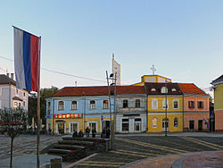
Derventa
|
Derventa Дервента |
|
|---|---|
 |
|
 Location of Derventa within Republika Srpska |
|
| Coordinates: 44°59′N 17°54′E / 44.983°N 17.900°E | |
| Country |
|
| Entity |
|
| Region | Posavina |
| Government | |
| • Mayor | Milorad Simić (SNSD) [1] |
| Area | |
| • Total | 516,84 km2 (19,955 sq mi) |
| Population (2013 census) | |
| • Total | 30,177 |
| • Density | 58,4/km2 (1,510/sq mi) |
| Time zone | CET (UTC+1) |
| • Summer (DST) | CEST (UTC+2) |
| Area code(s) | 53 |
| Website | www.derventa.ba |
Derventa (Serbian Cyrillic: Дервента) is a town and municipality just northwest of the town of Doboj, in the Posavina region. The municipality comprises 57 villages as well as the town itself. Derventa is a part of the Republika Srpska entity in Bosnia and Herzegovina.
The Derventa municipality borders with Brod, Modriča, Doboj, Prnjavor and Srbac, as well as Croatia across the Sava river. It has an area of 517 km2 (200 sq mi) and includes 57 villages in addition to the actual town of Derventa.
The town of Derventa lies on the river Ukrina, and roads lead from it to Bosanski Brod, Kotorsko (Doboj), Prnjavor (Banja Luka) and Srbac.
The town has a suburb called Derventski Lug which has grown substantially in recent years due to growth of Municipality.
• Agići • Begluci • Bijelo Brdo • Bosanski Dubočac • Brezici • Bukovac • Bukovica Mala • Bukovica Velika • Bunar • Cerani • Crnča • Dažnica • Derventa • Donja Bišnja • Donja Lupljanica • Donji Detlak • Donji Višnjik • Drijen • Gornja Bišnja • Gornja Lupljanica • Gornji Božinci • Gornji Detlak • Gornji Višnjik • Gradac • Gradina • Kalenderovci Donji • Kalenderovci Gornji • Kostreš • Kovačevci • Kulina • Kuljenovci • Derventski Lug • Lužani • Lužani Bosanski • Lužani Novi • Mala Sočanica • Mišinci • Miškovci • Modran • Osinja • Osojci • Pjevalovac • Pojezna • Poljari • Polje • Rapćani • Stanići • Šušnjari • Tetima • Trstenci • Tunjestala • Velika • Velika Sočanica • Vrhovi • Zelenike • Žeravac i Živinice.
...
Wikipedia
