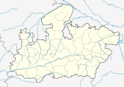
Depalpur, India
|
Depalpur देपालपुर |
|
|---|---|
| city | |
| Location in Madhya Pradesh, India | |
| Coordinates: 22°51′N 75°33′E / 22.85°N 75.55°ECoordinates: 22°51′N 75°33′E / 22.85°N 75.55°E | |
| Country |
|
| State | Madhya Pradesh |
| District | Indore |
| Government | |
| • Type | Municipal corporation |
| Elevation | 533 m (1,749 ft) |
| Population (2011) | |
| • Total | 25,300 |
| Languages | |
| • Official | Hindi |
| Time zone | IST (UTC+5:30) |
| ISO 3166 code | IN-MP |
| Vehicle registration | MP |
Depalpur is a town and a nagar panchayat in Indore district in the state of Madhya Pradesh, India.
According to tradition, the town is named after the Paramara dynasty ruler Devapala (reigned 1216–40).
In the Ain-i-Akbari, Depalpur is mentioned as one of the 10 mahals of Ujjain sarkar in Malwa Subah. Later, it became part of the princely state of Indore.
Depalpur is located at 22°51′N 75°33′E / 22.85°N 75.55°E. It has an average elevation of 533 metres (1748 feet).
As of 2001[update] India census, Depalpur had a population of 15,200. Males constitute 51% of the population and females 49%. Depalpur has an average literacy rate of 57%, lower than the national average of 59.5%: male literacy is 69% and, female literacy is 45%. In Depalpur, 16% of the population is under 6 years of age.
...
Wikipedia


