Delran Township, New Jersey
| Delran Township, New Jersey | |
|---|---|
| Township | |
| Township of Delran | |

Swede's Lake
|
|
 Delran highlighted in Burlington County. Inset map: Burlington County highlighted in the State of New Jersey. |
|
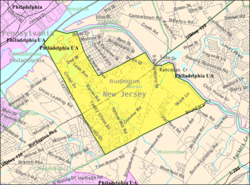
 Census Bureau map of Delran Township, New Jersey |
|
| Coordinates: 40°00′47″N 74°56′51″W / 40.013024°N 74.947423°WCoordinates: 40°00′47″N 74°56′51″W / 40.013024°N 74.947423°W | |
| Country | |
| State |
|
| County | Burlington |
| Incorporated | February 12, 1880 |
| Named for | DELaware River and RANcocas Creek |
| Government | |
| • Type | Mayor-Council |
| • Body | Township Council |
| • Mayor | Kenneth Paris (term ends December 31, 2016) |
| • Administrator | Jeffrey Hatcher |
| • Clerk | Jamey Eggers |
| Area | |
| • Total | 7.206 sq mi (18.664 km2) |
| • Land | 6.591 sq mi (17.071 km2) |
| • Water | 0.615 sq mi (1.593 km2) 8.54% |
| Area rank | 240th of 566 in state 24th of 40 in county |
| Elevation | 69 ft (21 m) |
| Population (2010 Census) | |
| • Total | 16,896 |
| • Estimate (2015) | 16,767 |
| • Rank | 148th of 566 in state 9th of 40 in county |
| • Density | 2,563.4/sq mi (989.7/km2) |
| • Density rank | 240th of 566 in state 12th of 40 in county |
| Time zone | Eastern (EST) (UTC-5) |
| • Summer (DST) | Eastern (EDT) (UTC-4) |
| ZIP code | 08075 |
| Area code(s) | 856 exchanges: 461, 764, 824 |
| FIPS code | 3400517440 |
| GNIS feature ID | 0882097 |
| Website | www |
Delran Township is a township in Burlington County, New Jersey, United States. As of the 2010 United States Census, the township's population was 16,896, reflecting an increase of 1,360 (+8.8%) from the 15,536 counted in the 2000 Census, which had in turn increased by 2,358 (+17.9%) from the 13,178 counted in the 1990 Census.
Delran Township was incorporated as a township by an act of the New Jersey Legislature on February 12, 1880, from portions of Cinnaminson Township. Portions of the township were taken to create Riverside Township on February 20, 1895.
The township's name is a portmanteau of the names of the two waterways that have their confluence here: the Delaware River and Rancocas Creek.
According to the United States Census Bureau, the township had a total area of 7.206 square miles (18.664 km2), including 6.591 square miles (17.071 km2) is land and 0.615 square mile (1.593 km2) of water (8.54%).
The township borders Delanco Township, Riverside Township, Moorestown Township, Willingboro Township, and Cinnaminson Township, as well as the Delaware River.
Unincorporated communities, localities and place names located partially or completely within the township include Bridgeboro, Cambridge, Chesterville, Fairview, Milltown and Riverside Park.
...
Wikipedia
