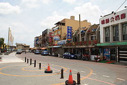
Dayuan District
|
Dayuan 大園區 |
|
|---|---|
| District | |
| Dayuan District | |
 |
|
 |
|
| Coordinates: 25°03′N 121°11′E / 25.050°N 121.183°ECoordinates: 25°03′N 121°11′E / 25.050°N 121.183°E | |
| Country | Taiwan |
| Municipality | Taoyuan City |
| Government | |
| • Mayor | Lu Shuitian |
| Area | |
| • Total | 87.3925 km2 (33.7424 sq mi) |
| Population (January 2016) | |
| • Total | 85,667 |
| • Density | 980/km2 (2,500/sq mi) |
| Website | www.dayuan.tycg.gov.tw |
Dayuan District (Chinese: 大園區; pinyin: Dàyuán Qū), formerly known as Dayuan Township (Chinese: 大園鄉; pinyin: Dàyuán Xiāng) is a rural, coastal district in northwestern Taoyuan City, Taiwan (Republic of China).
Dayuan District was originally named Toa-khu-hng (Chinese: 大坵園; Pe̍h-ōe-jī: Toā-khu-hn̂g). It was changed to Ōsono Village (大園庄?) during Japanese rule, and it was part of Tōen District, Shinchiku Prefecture. After the handover of Taiwan from Japan to the Republic of China, it was called Dayuan Township. It became Dayuan District in 2014, when Taoyuan County and the city of Taoyuan merged into a special municipality.
The population in 1986 was 56,995. By the end of May 2006, the total population had grown to 79,812, an average growth rate of 2.03%. It is considered a slow population growing district.
Dayuan District has an inclining topography from southwest to northwest with an average height of 35 meters above sea level. Inland area are mostly plains, rice fields or spacious flat lands, while in the northeast part is the prolonged sand beach seacoast.
...
Wikipedia
