Davis, West Virginia
| Davis, West Virginia | |
|---|---|
| Town | |

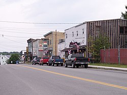
William Avenue (Route 32) in Davis in 2006
|
|
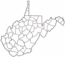
 Location of Davis, West Virginia |
|
| Coordinates: 39°7′52″N 79°27′59″W / 39.13111°N 79.46639°WCoordinates: 39°7′52″N 79°27′59″W / 39.13111°N 79.46639°W | |
| Country | United States |
| State | West Virginia |
| County | Tucker |
| Area | |
| • Total | 1.83 sq mi (4.74 km2) |
| • Land | 1.83 sq mi (4.74 km2) |
| • Water | 0 sq mi (0 km2) |
| Elevation | 3,100 ft (945 m) |
| Population (2010) | |
| • Total | 660 |
| • Estimate (2012) | 650 |
| • Density | 360.7/sq mi (139.3/km2) |
| Time zone | Eastern (EST) (UTC-5) |
| • Summer (DST) | EDT (UTC-4) |
| ZIP code | 26260 |
| Area code(s) | 304 |
| FIPS code | 54-20428 |
| GNIS feature ID | 1550876 |
Davis is a town in Tucker County, West Virginia, along the Blackwater River. The population was 660 at the 2010 census.
Davis was named either for Senator Henry Gassaway Davis, or for his family generally.
The Herman August Meyer House was listed on the National Register of Historic Places in 2010.
Davis is located at 39°07′52″N 79°27′59″W / 39.131110°N 79.466318°W (39.131110, -79.466318). It is located in the northern portion of the Canaan Valley, West Virginia near the Canaan Valley State Resort Park, and is partially surrounded by the Monongahela National Forest including scenic Blackwater Falls.
At an elevation of 3,100 feet, Davis has the highest elevation of any West Virginia town.
According to the United States Census Bureau, the town has a total area of 1.83 square miles (4.74 km2), all of it land.
The area surrounding Davis is renowned for its mountain biking trails and bike culture. The most notable trails include the Plantation Trail, Hoo Doo Hustle and Moon Rocks. Many more miles of trails are also easily accessible at nearby Blackwater Falls State Park. The area also hosts several mountain bike races each year. One of these races, The Revenge Of The Rattlesnake, is considered one of the toughest bike races in the country.
...
Wikipedia
