Daulatpur, Himachal Pradesh
| Daulatpur Chowk | |
|---|---|
| town | |
| Coordinates: 31°48′N 75°59′E / 31.8°N 75.98°ECoordinates: 31°48′N 75°59′E / 31.8°N 75.98°E | |
| Country |
|
| State | Himachal Pradesh |
| District | Una |
| Elevation | 521 m (1,709 ft) |
| Population (2001) | |
| • Total | 3,352 |
| Languages | |
| • Official | Hindi |
| • Local | Punjabi |
| Time zone | IST (UTC+5:30) |
| Vehicle registration | HP- |
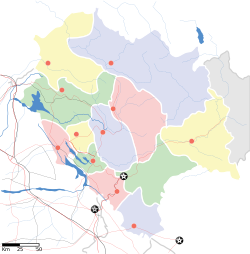
Daulatpur is a town and a nagar panchayat in Tehsil Ghanari of Una district in the state of Himachal Pradesh, India. It is situated in the Punjab region of Indian Subcontinent
Daulatpur is located at 31°48′N 75°59′E / 31.8°N 75.98°E. It has an average elevation of 521 metres (1709 feet).
As of 2001[update] India census, Daulatpur had a population of 3352. Males constitute 50% of the population and females 50%. Daulatpur has an average literacy rate of 79%, higher than the national average of 74.04%: male literacy is 82% and, female literacy is 76%. In Daulatpur, 11% of the population is under 6 years of age.
...
Wikipedia


