Dønna
| Dønna kommune | |||
|---|---|---|---|
| Municipality | |||
 |
|||
|
|||
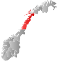
 Dønna within Nordland |
|||
| Coordinates: 66°5′29″N 12°31′33″E / 66.09139°N 12.52583°ECoordinates: 66°5′29″N 12°31′33″E / 66.09139°N 12.52583°E | |||
| Country | Norway | ||
| County | Nordland | ||
| District | Helgeland | ||
| Administrative centre | Solfjellsjøen | ||
| Government | |||
| • Mayor (2011) | Anne S. Mathisen (Ap) | ||
| Area | |||
| • Total | 193.90 km2 (74.87 sq mi) | ||
| • Land | 187.64 km2 (72.45 sq mi) | ||
| • Water | 6.26 km2 (2.42 sq mi) | ||
| Area rank | 330 in Norway | ||
| Population (2011) | |||
| • Total | 1,449 | ||
| • Rank | 365 in Norway | ||
| • Density | 7.7/km2 (20/sq mi) | ||
| • Change (10 years) | -9.2 % | ||
| Demonym(s) | Dønnværing | ||
| Time zone | CET (UTC+1) | ||
| • Summer (DST) | CEST (UTC+2) | ||
| ISO 3166 code | NO-1827 | ||
| Official language form | Bokmål | ||
| Website | www |
||
|
|
|||
Dønna is an island and a municipality in Nordland county, Norway. It is part of the Helgeland region. The administrative centre of the island municipality is the village of Solfjellsjøen. Other villages include Bjørn, Dønnes, Hestad, Sandåker, and Vandve. The main island of Dønna is connected to Herøy to the south by the Åkviksundet Bridge.
The municipality of Dønna was established on 1 January 1962 when the municipality of Nordvik (population: 1,293) was merged with the part of Herøy on the southern tip of the island of Dønna (population: 19), the part of Nesna on the island Løkta (population: 80), and most of Dønnes municipality (population: 1,348). The borders have not changed since that time.
The municipality is named after the island of Dønna (Old Norse Dyn). The name is probably derived from the Norse verb dynja which means to "rumble" or "roar" (referring to the swell of the waves on the island).
The coat-of-arms is from modern times; they were granted on 29 May 1981. The arms show a wave as a canting symbol for the municipality since the Norwegian word dønning means wave.
...
Wikipedia


