Curuzú Cuatiá
| Curuzú Cuatiá | ||
|---|---|---|
| City | ||
|
||
 |
||
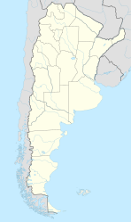
| Location of Curuzú Cuatiá in Argentina | ||
| Coordinates: 29°47′S 58°5′W / 29.783°S 58.083°WCoordinates: 29°47′S 58°5′W / 29.783°S 58.083°W | ||
| Country | Argentina | |
| Province | Corrientes | |
| Department | Curuzú Cuatiá | |
| Founded | November 16, 1810 | |
| Government | ||
| • Mayor | Alicia Locatelli de Rubin (Justicialist Party) | |
| Elevation | 61 m (200 ft) | |
| Population (2012) | ||
| • Total | 33,089 | |
| Demonym(s) | curuzucuateña/o | |
| Time zone | ART (UTC-3) | |
| CPA base | W3460 | |
| Dialing code | +54 3774 | |
| Website | Official website | |
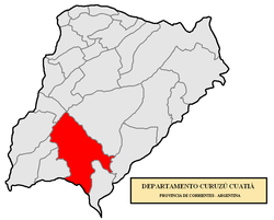
Curuzú Cuatiá is a city in the south of the province of Corrientes in the Argentine Mesopotamia. It had about 50,000 inhabitants at the 2001 census [INDEC], and is the head town of the Curuzú Cuatiá Department.
The area has an undulated terrain, with many small rivers and streams that empty into the Paraná River in the west, or into the Uruguay River in the east. The climate is wet subtropical, with uniformly distributed annual rainfall of 1,200 mm on average. The average temperatures are 14.5 °C (winter) and 26 °C (summer), with recorded extremes of −3 °C and 44 °C respectively.
The city is served by an airport (IATA: UZU, ICAO: SATU), located at 29°47′S 58°1′W / 29.783°S 58.017°W.
The name Curuzú Cuatiá is of Guaraní origin and means "Engraved Cross". The early settlers (Spanish conquistadores and Jesuit missionaries from Uruguay) called it Posta de Cruz since the site was a crossroads, marked by a large cross with an inscription.
...
Wikipedia


