Curepipe
|
Curepipe La Ville-Lumière |
||
|---|---|---|
| Town | ||
| Curepipe | ||

The view from Trou aux Cerfs, one of the highest points in Curepipe.
|
||
|
||
| Motto: "Exselsus Splendeo" (Latin) (Meaning "Exalted Shine" in English) |
||
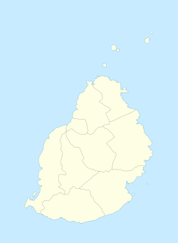
| Municipal Council location | ||
| Coordinates: 20°19′7.59″S 57°31′34.66″E / 20.3187750°S 57.5262944°ECoordinates: 20°19′7.59″S 57°31′34.66″E / 20.3187750°S 57.5262944°E | ||
| Country |
|
|
| Districts | Plaines Wilhems | |
| Government | ||
| • Type | Municipality | |
| • Mayor | Stephanie Nathalie Fabiola Gopee | |
| • Deputy Mayor | Devindranath Bhurosah | |
| Area | ||
| • Total | 24 km2 (9 sq mi) | |
| Elevation | 561 m (1,841 ft) | |
| Population (2015) | ||
| • Total | 79,014 | |
| • Rank | 5th in Mauritius | |
| • Density | 3,207.9/km2 (8,308/sq mi) | |
| Time zone | MUT (UTC+4) | |
| ISO 3166 code | MU-CU | |
| Climate | Cfa | |
| Website | Municipal Council | |
Curepipe also known as La Ville-Lumière (The City of Light), is a town in Mauritius, located in the Plaines Wilhems District, the eastern part also lies in the Moka District. The town is administered by the Municipal Council of Curepipe. Curepipe lies at a higher elevation, often referred to as the "Central Plateau". According to the census made by Statistics Mauritius in 2015, the population of the town was at 79,014.
The town's name, Curepipe, is said to be originated from the French curer sa pipe, which translates to "cleaning the pipe". There are several theories by historians as to the naming of the city. Some historians believe that the name was given as travelers and soldiers from the 19th century often traveled from Port Louis and Grand Port (now Mahébourg) to refill their pipes in Curepipe. Other historians believe that the name was given after a late landowner during the 18th century.
The town officially covers an area of 23.8 square kilometres (9.2 sq mi). It is located in the Plaine Wilhems district on the central plateau of Mauritius at an altitude of 561 meters. Of the larger towns of the island's central plateau, Curepipe is the most southern and also the highest. As a consequence of its height, Curepipe is known for its relatively cool and rainy climate.
Curepipe is managed by a council, which is democratically elected by its citizens. The council is headed by the Mayor and is principally responsible for local policy making. The current Mayor is Nathalie Stephanie Gopee (elected June 2015). The town's administration on the other hand is responsible for the implementation of these policies as well as the day-to-day management of the council's activities. The current administrative head is Mr Vineshsing Seeparsad, who joined the local government in March 2011.
Curepipe's historic town hall was actually originally situated in Moka, and the whole building was moved to Curepipe in 1903.
For the general elections the town is classified as the No 17 constituency known as Curepipe and Midlands.
According to the census made by Statistics Mauritius in 2015, the population of the town was at 79,014. The primary spoken language is Mauritian Creole, though French predominates in more formal situations. Tamil, Bhojpuri, Hindi, Telugu, Urdu, Mandarin and Hakka Chinese are also spoken as second or third language mostly in religious activities. The council's official language is English.
...
Wikipedia


