Plaines Wilhems District
| Plaines Wilhems | |
|---|---|
| District | |

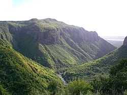
Tamarind falls
|
|
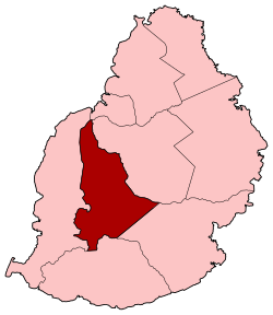
 Map of Mauritius island with Plaines Wilhems District highlighted |
|
| Coordinates: 20°18′S 57°29′E / 20.300°S 57.483°ECoordinates: 20°18′S 57°29′E / 20.300°S 57.483°E | |
| Country |
|
| Government | |
| Area | |
| • Total | 203.3 km2 (78.5 sq mi) |
| Population (2015) | |
| • Total | 368,621 |
| • Rank | 1st in Mauritius |
| • Density | 1,800/km2 (4,700/sq mi) |
| Time zone | MUT (UTC+4) |
| ISO 3166 code | MU-PW (Plaines Wilhems) |
Plaines Wilhems is a district of Mauritius. It is the most populous district, with its population estimated at 368,621 as of 31 December 2015[update]. The district is mainly urban; it consists of four towns, the village of Midlands and part of two other villages. The Plaines Wilhems district does not have a District Council; it has four Municipal Town Councils. The towns are Beau-Bassin Rose-Hill, Curepipe, Quatre Bornes and Vacoas-Phoenix. The villages are Midlands, Cascavelle (East - West in Rivière Noire district) and Moka (West- East in Moka district). The district was named after Wilhem Leicknig. Of Prussian origin, he settled on the island of Mauritius, then known as Isle de France, in 1721.
Secondary schools in the district include:
...
Wikipedia
