Port Louis
|
Port Louis Port-Louis (French) Porlwi (Mauritian creole) |
|||
|---|---|---|---|
| City | |||

Aerial view of Port Louis
|
|||
|
|||
| Motto: "Concordia et Progressio" (Latin for "Harmony and Progress") |
|||
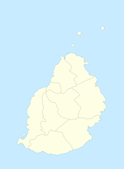
| Municipal Council location | |||
| Coordinates: 20°9′51.7896″S 57°30′14.7738″E / 20.164386000°S 57.504103833°ECoordinates: 20°9′51.7896″S 57°30′14.7738″E / 20.164386000°S 57.504103833°E | |||
| Country |
|
||
| Districts | Port Louis District | ||
| Town | 25 August 1966 | ||
| City | 12 December 2011 | ||
| Government | |||
| • Type | Municipality | ||
| • Lord Mayor | Mr. Kholeegan Mohammad Oumar | ||
| • Deputy Lord Mayor | Mr. Chris Loïc Dick | ||
| Area | |||
| • Total | 46.7 km2 (18.0 sq mi) | ||
| Population (2015) | |||
| • Total | 149,194 | ||
| • Rank | 1st in Mauritius | ||
| • Density | 3,200/km2 (8,300/sq mi) | ||
| Time zone | MUT (UTC+4) | ||
| Website | Municipal Council | ||
Port Louis (French: Port-Louis, Mauritian Creole: Porlwi) is the capital city of Mauritius, located in the Port Louis District, the western part also lies in the Black River District. Port Louis is the country's economic, cultural, political centre and most populous city. It is administered by the Municipal City Council of Port Louis. According to the 2012 census conducted by Statistics Mauritius, the population was 149,194.
Port Louis was already in use as a harbor in 1638. In 1735, under French government, it became the administrative center of Mauritius and a major reprovisioning halt for French ships during their passage between Asia and Europe, around the Cape of Good Hope. The Port is named in honor of King Louis XV. During this period of French colonization, Mauritius was known as Ile de France. The French governor at that time, Bertrand-François Mahé de Labourdonnais, contributed to the development of the city. Since Port Louis was relatively well-protected from strong winds during cyclones by the Moka Mountain Range, Port Louis was selected to house both the main harbor and fort for the island. Value of the port continued during the British occupation of the island during the Napoleonic Wars (1800–15), and helped Britain control the Indian Ocean. However, port calls of ships fell drastically following the opening of the Suez Canal in 1869. Activity in the port increased during the seven-year closure of the Suez Canal (starting in 1967). Modernization of the port in the late 1970s has helped it maintain its role as the central point for all imports and exports from Mauritius. While Port Louis continues to be the business and administrative capital of Mauritius, expansion of the tourism industry in the late 1990s led to considerable development in Port Louis, with many shops, hotels, and restaurants being built in the Caudan Waterfront area.
Port Louis features a hot semi-arid climate (BSh) under Köppen's climate classification. Its wettest months are from December through April where on average 60 mm (2.4 in) (or more) of rain falls during each of these months. The remaining months forms Port Louis' dry season. The city also shows a noticeable range of average temperatures. Port Louis’ coolest temperatures are seen mid-year where average high temperatures are around 24 °C (75 °F). During the height of the wet season, the city sees its highest temperatures where average high temperatures are usually around 30 °C (86 °F)
...
Wikipedia


