Cumberland, MD
| Cumberland, Maryland | ||
|---|---|---|
| City | ||
| City of Cumberland | ||

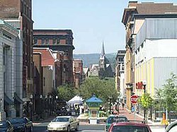
Downtown Cumberland in July 2001
|
||
|
||
| Nickname(s): "Queen City", "C-Land" | ||
| Motto: "Come for a Visit, Stay for Life!" | ||
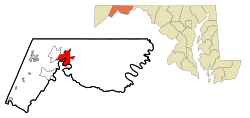
 Location in Allegany County and in Maryland |
||
| Location within the state of Maryland | ||
| Coordinates: 39°38′52″N 78°45′46″W / 39.64778°N 78.76278°WCoordinates: 39°38′52″N 78°45′46″W / 39.64778°N 78.76278°W | ||
| Country | United States of America | |
| State | Maryland | |
| County | Allegany | |
| Founded | 1787 | |
| Incorporated | 1815 | |
| Government | ||
| • Type | Council-CEO | |
| • Mayor | Brian Grim | |
| • City administrator | Jeff Rhodes as of December 20, 2011 | |
| Area | ||
| • City | 10.15 sq mi (26.29 km2) | |
| • Land | 10.08 sq mi (26.11 km2) | |
| • Water | 0.07 sq mi (0.18 km2) | |
| Elevation | 627 ft (191 m) | |
| Population (2010) | ||
| • City | 20,859 | |
| • Estimate (2015) | 20,130 | |
| • Density | 2,069.3/sq mi (799.0/km2) | |
| • Metro | 103,299 | |
| • Demonym | Cumberlander | |
| Time zone | Eastern (EST) (UTC-5) | |
| • Summer (DST) | EDT (UTC-4) | |
| ZIP codes | 21501-21505 | |
| Area code(s) | 301, 240 | |
| FIPS code | 24-21325 | |
| GNIS feature ID | 0590057 | |
| Website | www.ci.cumberland.md.us | |
Cumberland, officially the City of Cumberland, is a western gateway city and seat of Allegany County, Maryland, and the primary city of the Cumberland, MD-WV Metropolitan Statistical Area. At the 2010 census, the city had a population of 20,859, and the metropolitan area had a population of 103,299. Cumberland is a regional business and commercial center for Western Maryland and the Potomac Highlands of West Virginia.
Historically Cumberland was known as the "Queen City," as it was once the second largest in the state. Because of its strategic location on what became known as the Cumberland Road through the Appalachians, after the American Revolution it served as a historical outfitting and staging point for westward emigrant trail migrations throughout the first half of the 1800s. In this role, it supported the settlement of the Ohio Country and the lands in that latitude of the Louisiana Purchase. It also became an industrial center, served by major roads, a canal connecting to Washington, DC, and railroads.
Industry declined after World War II. Much of the later urban, business and technological development in the state has been concentrated in eastern coastal cities. Today the Cumberland, MD-WV Metropolitan Statistical Area is one of the poorest in the United States, ranking 305th out of 318 metropolitan areas in per capita income.
Cumberland was named by English colonists after the son of King George II, Prince William, the Duke of Cumberland. It is built on the site of the mid-18th century Fort Cumberland, the starting point for British General Edward Braddock's ill-fated attack on the French stronghold of Fort Duquesne (present-day Pittsburgh) during the French and Indian War, the North American front of the Seven Years' War between the French and the British. (See Braddock expedition.) This area had long been settled for thousands of years by indigenous peoples. The fort was developed along the Great Indian Warpath which tribes used to travel the backcountry.
...
Wikipedia


