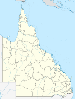
Cubbie Station
| Cubbie Station | |
|---|---|
| Location in Queensland | |
| Type | Irrigated agriculture |
| Location | near Dirranbandi, Queensland, Australia |
| Coordinates | 28°42′21″S 147°52′28″E / 28.70583°S 147.87444°ECoordinates: 28°42′21″S 147°52′28″E / 28.70583°S 147.87444°E |
| Area | 96,000 hectares (240,000 acres) |
| Operated by | Lempriere Group for CS Agriculture, a subsidiary of Shandong RuYi |
Cubbie Station, the largest irrigation property in the southern hemisphere, is located near Dirranbandi, in south west Queensland, Australia. The station comprises 96,000 hectares (240,000 acres) and is managed by the Lempriere Group, on behalf of CS Agriculture, a joint venture between Lempriere and Shandong RuYi Group, a textile manufacturer owned by investors from China and Japan.
The station has significant water rights to flows along the Culgoa River, within the Murray-Darling basin.
Cubbie Station is located on the Darling Riverine Plains bioregion. The topography of the region is defined by channels and floodplains of the upper reaches of the Darling and Barwon rivers.
Cotton was first produced in the region from the late 1970s. In 1983, Cubbie Station was converted from grazing purposes to cotton production. Cubbie Station comprises agricultural and non-agricultural lands; with approximately 22,000 hectares (54,000 acres) presently developed and a further 11,000 hectares (27,000 acres) under development.
The station was created by amalgamating twelve floodplain properties to give Cubbie a total of fifty-one licences. The station's water storage dams stretch for more than 28 kilometres (17 mi) along the Culgoa River, within the Murray-Darling basin. In an average year the station uses 200,000 megalitres (7,100×106 cu ft) of water, in a good year as much as 500,000 megalitres (18,000×106 cu ft).
...
Wikipedia

